Navigation
Install the app
How to install the app on iOS
Follow along with the video below to see how to install our site as a web app on your home screen.
Note: This feature may not be available in some browsers.
More options
You are using an out of date browser. It may not display this or other websites correctly.
You should upgrade or use an alternative browser.
You should upgrade or use an alternative browser.
Drought for the west
- Thread starter rick19Kilo
- Start date
JEL
Well-known member
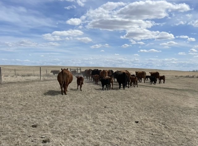
DamnMoving pairs to better pasture. Won’t last long. We haul water since the reservoirs are dry and a day after setting a tank we had antelope hitting it. Tough conditions all around up here. View attachment 222849
antlerradar
Well-known member
That looks tough.Moving pairs to better pasture. Won’t last long. We haul water since the reservoirs are dry and a day after setting a tank we had antelope hitting it. Tough conditions all around up here. View attachment 222849
drifter52
Active member
- Joined
- May 15, 2022
- Messages
- 102
They look healthy enoughMoving pairs to better pasture. Won’t last long. We haul water since the reservoirs are dry and a day after setting a tank we had antelope hitting it. Tough conditions all around up here. View attachment 222849
JEL
Well-known member
Supplements. Usually not necessary this time of year.They look healthy enough
elkduds
Well-known member
elkduds
Well-known member
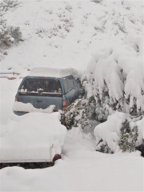
And it is very wet snow
Alabama
Active member
Do you know how much snow there was in the Wet Mtns south of Canon City? I know some of that country went from severe to extreme drought when the drought monitor came out Thursday. I'm glad you guys are getting some moisture.And it is very wet snow
elkduds
Well-known member
Looks like 10ish inches around Westcliffe. It has been an average wet spring farther south by Rye.Do you know how much snow there was in the Wet Mtns south of Canon City? I know some of that country went from severe to extreme drought when the drought monitor came out Thursday. I'm glad you guys are getting some moisture.
Update, Beulah, 14"
Last edited:
shrapnel
Well-known member
- Joined
- Aug 27, 2015
- Messages
- 2,790
I normally look at the country-wide 24 hour radar loop every day or two. With the drought as severe as it is I always glance towards the western states to see if it's raining. I see on the radar that northern New Mexico has some sprinkles showing up. Is it hitting the ground down there @hank4elk
El Jason
Well-known member
We just picked up another 0.1” 0.25” or so. It’s amazing the difference between this spring and last. I haven’t seen balsam root this tall and thick in 4-5 years.
We’re still listed as moderate drought status, but timing of the precipitation has been outstanding.
We’re still listed as moderate drought status, but timing of the precipitation has been outstanding.
Last edited by a moderator:
Lots of info.

 www.drought.gov

Drought Update for the Intermountain West
NIDIS and its partners will issue future drought status updates as conditions evolve.
Had some virga around sunset yesterday, mixed in a sandstorm.I normally look at the country-wide 24 hour radar loop every day or two. With the drought as severe as it is I always glance towards the western states to see if it's raining. I see on the radar that northern New Mexico has some sprinkles showing up. Is it hitting the ground down there @hank4elk
The term drier than a popcorn fart was mentioned to me twice by old timers in town early voting. Bad as it gets, is the common term by locals way older than me. Sand building up around the gramma grass in places.
Only glimpse of hope is that SW NM could be in for higher than average monsoon, if it gets to us soon enough.
Another day of extreme fire danger today ,winds 40mph.
marksjeep
Well-known member
Good info. Snowmelt runoff leaving the state tanked with the colder weather. Might rebound next week a touch. Historic median streamflow at state line is > 10kcfs from May 15 thru June, with close to 30 days > 15kcfs. Not this year. April-June runoff volume forecast for the entire basin in your link is dismal.
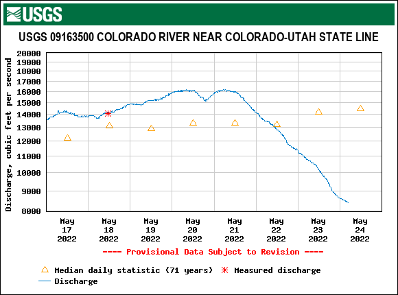
https://waterdata.usgs.gov/nwis/dvstat/?referred_module=sw&site_no=09163500&por_09163500_19083=345733,00060,19083,1951-05-01,2021-11-07&format=html_table&stat_cds=p50_va&date_format=YYYY-MM-DD&rdb_compression=file&submitted_form=parameter_selection_list

https://waterdata.usgs.gov/nwis/dvstat/?referred_module=sw&site_no=09163500&por_09163500_19083=345733,00060,19083,1951-05-01,2021-11-07&format=html_table&stat_cds=p50_va&date_format=YYYY-MM-DD&rdb_compression=file&submitted_form=parameter_selection_list
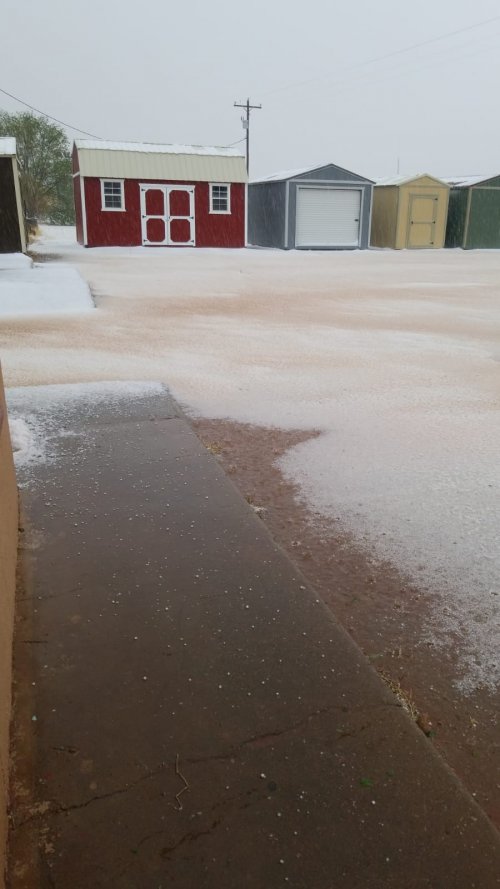
We've received about an inch of precip in two events since last Wednesday. Unfortunately one of those events dropped lots of lightning and started a new fire. Looks like yesterday's moisture helped to call it contained.Had some virga around sunset yesterday, mixed in a sandstorm.
The term drier than a popcorn fart was mentioned to me twice by old timers in town early voting. Bad as it gets, is the common term by locals way older than me. Sand building up around the gramma grass in places.
Only glimpse of hope is that SW NM could be in for higher than average monsoon, if it gets to us soon enough.
Another day of extreme fire danger today ,winds 40mph.
mountainlaurel3
Well-known member
I've checked out a few of the mid-high elevation rivers in the San Juans and they are looking way too fishable. Should be blown out for weeks longer, but they've already dropped substantially and cleared.
Terrible spring skiing year, too, as we should be in prime corn harvest but there's barely any snow left.
Terrible spring skiing year, too, as we should be in prime corn harvest but there's barely any snow left.
Valley1320
Well-known member
Similar threads
- Replies
- 35
- Views
- 1K
- Replies
- 187
- Views
- 11K
- Replies
- 140
- Views
- 8K


