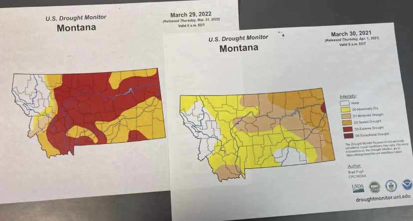
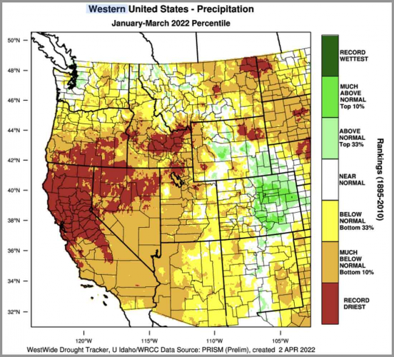
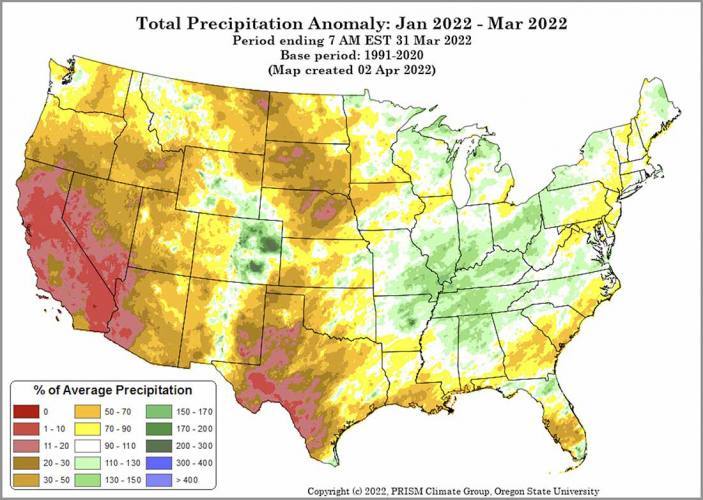
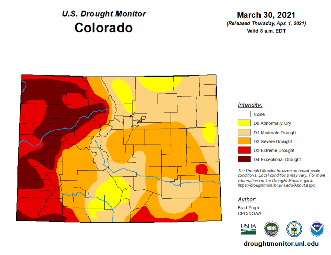
Drought for the west

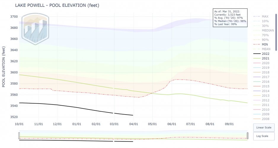
About 30 ft more foot drop,and the intakes will be completly out of the water, a dead pool !
"Dead pool" is a very specific term. From the link below, Water above 1,050 feet elevation is considered “live storage” and a “dead pool” exists at 895 feet in elevation, which is the lowest water outlet at Hoover Dam.

Current elevation is 1060, so 165 feet to dead pool. Roughly 10 feet to inactive storage, where hydropower is affected (reduced capacity). 950 is the bottom of the minimum power pool, below which there is no power generation.

https://www.nps.gov/lake/learn/nature/storage-capacity-of-lake-mead.htm#:~:text=The minimum elevation to generate,water outlet at Hoover Dam.


ETA - picked up a whooopin' 0.15" of precip at the casa overnight.
 
That first link is very interesting. That’s the first that I’ve heard that they may have overestimated the yearly runoff when they built the dams.
And they knew when they signed the compact that it was based on abnormally wet years. They just chose to ignore it. Eugene C. La Rue was hired by the USGS to locate dam sites on the Colorado River. In his 1916 report, he noted that
"...complete utilization and control of the stream waters in the upper basin will create a shortage of about 3,800,000 acre-feet in the supply available for the lower basin. More complete data would probably indicate a greater shortage in the water supply available for the irrigation of lands on the lower Colorado. Evidently the flow of Colorado River and its tributaries is not sufficient to irrigate all the irrigable lands lying within the basin."

He testified to Congress in 1925, and told them there was not enough water in the river for what they were planning. He referenced his 1916 report, and basically said that they had been warned for years.

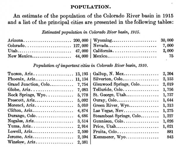
Here is the estimated population of the Colorado River basin when La Rue was completing his report on the river.

IMG_5240.JPG
 
I wonder how many bunker busters it would take to bring down the dam?
 
And they knew when they signed the compact that it was based on abnormally wet years. They just chose to ignore it. Eugene C. La Rue was hired by the USGS to locate dam sites on the Colorado River. In his 1916 report, he noted that


He testified to Congress in 1925, and told them there was not enough water in the river for what they were planning. He referenced his 1916 report, and basically said that they had been warned for years.

Here is the estimated population of the Colorado River basin when La Rue was completing his report on the river.

View attachment 217449
Nice to see WY hasn't changed much. I mean if you told me 843 people lived in Kemmerer if believe it.
 
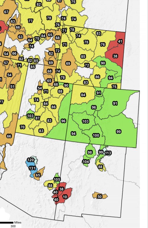
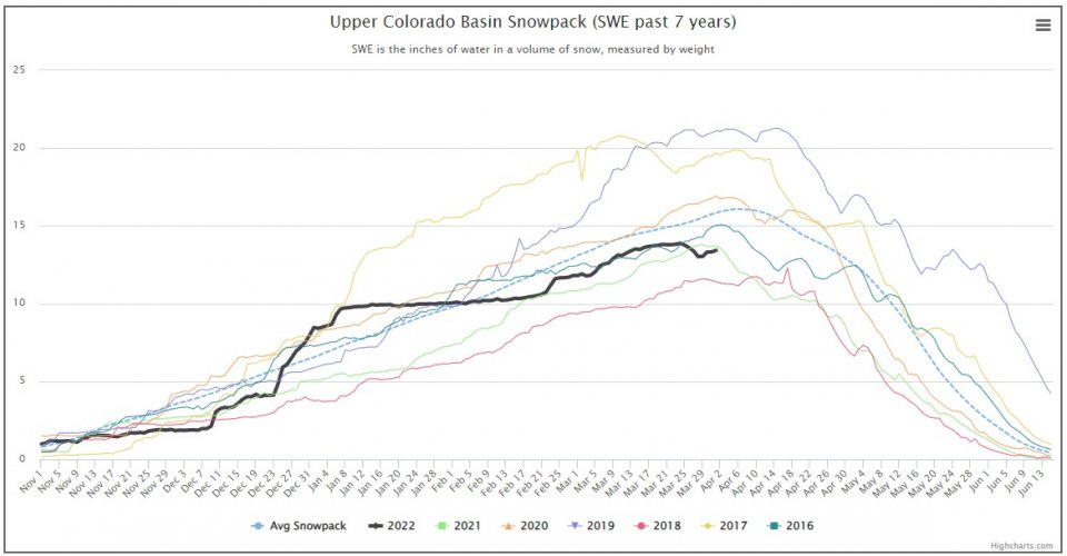
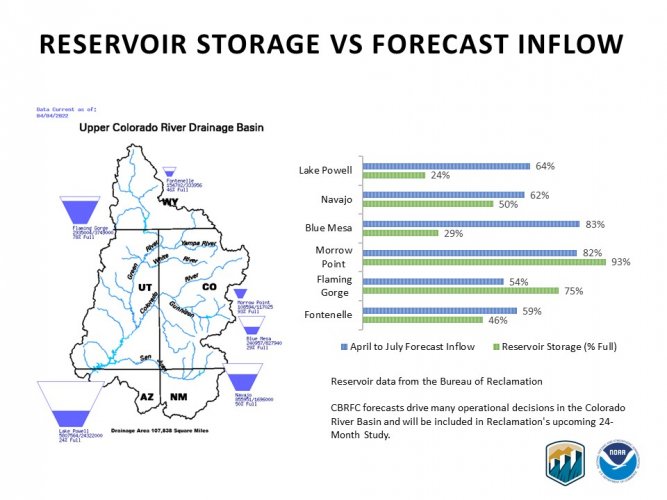
The upper Colorado looks pretty good. Should get a bump this year. It doesn’t solve anything long term, but it beats last year.

3C8EF3C5-7841-4930-A301-2C31DBA748BF.jpeg
 
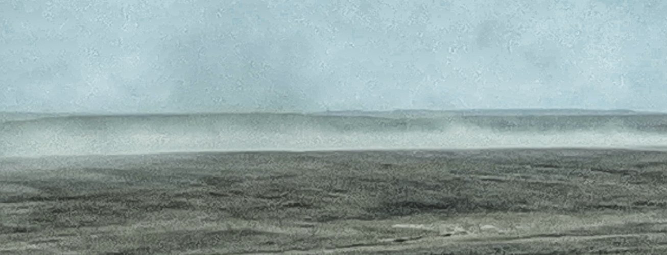
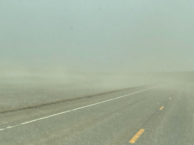
I was out in Northern yellowstone County thenother day and it's scarry dry. Starting to see wind generated soil erosion in spots that were grazed hard last year.
Noticed some of that too. We’ve been so dry and the wind has blown so much this spring. But it is currently raining outside and we are over 1/4” for the nights total rainfall. But 60mph winds coming soon so should dry up quick
 
Last edited:
So my rain gauge finally thawed and I got 2.1 inches in March to match the 2 in Feb & 2 in Dec & Nov. for a total of 12"+- for the year. No snow in Jan again this year.
Had a good monsoon that lacked any rain in July after getting it in June which has not happened in 13 yrs.
12" is not the 14" I was told is the average for this area of NM 20 years ago. They also said you could run a dozen head on a section here....lol

Large Pinions still dying from IPPS ,stressed. The good news is all the small trees are doing very good with no signs of beetles or stress. And I have hundreds of small trees that have come up in the 13 years since I moved here. Lucky for me the pinion have outgrown any juniper that have come up.

My shortgrass prairie grasses have recovered from overgrazing and the bald windblown areas have stabilized. Forage brush has also grown back and waiting for the deer again. Lots of elk & antelope.
 
I know this was talked about back in March from the threads I saw.

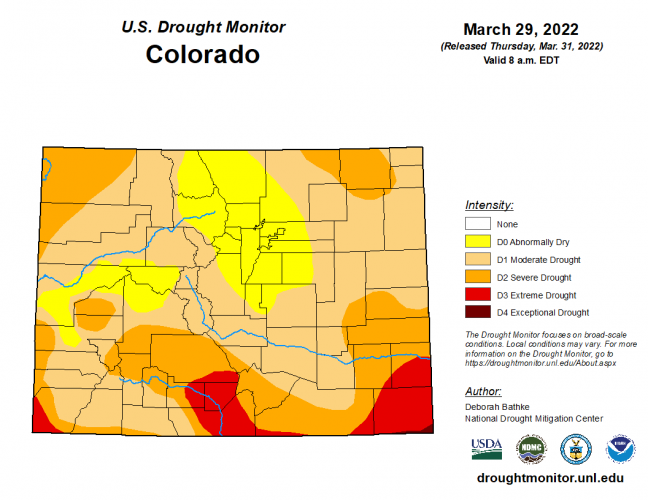
Does anyone have any boots on the ground knowledge regarding how bad this years drought affected habitat in Colorado for the western half of the state?

April was pretty dry according to this online tool: https://droughtmonitor.unl.edu/Maps/ComparisonSlider.aspx

I am doing an OTC elk hunt and am starting to wonder how much this is going to add to the difficulty meter on finding healthy elk numbers? Obviously look for water, but I think everyone will be sitting water this year.

I have in my mind this cartoon drawing of 20 hunters with their bows, hiding in the bushes surrounding a three foot wide wallow.
I think we are going to see a continuation of one of the driest 5 years on record. Northern Ca at Lake Shasta is a mud puddle and no significant rain in the forecast. I have enough points for a great both elk and deer hunt in Colorado but I cant risk burning 24 years of waiting to hunt during this drought. I made that mistake during the last drought here a few years back in Northern Calif X zone and the ground was so dry its was cracking open. Saw more mountain lion evidence/sign than deer deer. I am opting to just hold on for another point for both elk & deer in Colorado and do more research etc. Hope for the weather patterns to get back to normal. Wish you the best; Good luck if you go.
 
SITKA Gear

Latest posts

Forum statistics

Threads
113,581
Messages
2,025,864
Members
36,237
Latest member
SCOOTER848
Back
Top