Leupold BX-4 Rangefinding Binoculars

OnX is not always correct

It does get confusing, and people are repeatedly breaking the law on DNRC roads. A study on centralizing road maps and/or actually doing some travel planning on state trust lands would go a lot farther to easing the concerns and confusion.
Its pretty straight forward. If it’s not a state or county road it’s closed unless designated open. There aren’t very many roads that are designated open. They will be signed open. If you don’t know, don’t go! That’s always the adage that will keep you out of trouble.
 
Its pretty straight forward. If it’s not a state or county road it’s closed unless designated open. There aren’t very many roads that are designated open. They will be signed open. If you don’t know, don’t go! That’s always the adage that will keep you out of trouble.

There are plenty of examples of open BLM tracks that cross small pieces of state land which are technically closed, and therefore, means landlocked public land because you can't take the road to get there (forget the walking for now).

There are no shortage of state trust roads that are closed, but join up with BuRec roads that are open.

There are plenty of two tracks that are closed, but are freaking highways considering the amount of traffic out on them illegally.

So while it may be clear as gin in your mind, the reality is telling us very different things that, a simple data layer available to all states would help fix.

It's a system that is opposite of the other public land agencies, therefore automatically creating more confusion. it's a system that the lessees really don't want to change because they're still not happy that hunters got the right to use those lands 25 years ago.

it's a system that's set up to generate revenue from leasing, not recreation. Hunting on state lands is still pretty darned new (25 years is all in MT) and the systems relative to their management have not kept up.
People don’t want to hear the roads are closed but that’s the case. I have turned in a ton of people and will continue to. And it gets enforced by our wardens in most cases. Most people go off “if it’s not signed“ I’m driving it. That can be fine on a lot of BLM lands. That will get you in a lot of trouble on state land. Again you will never get in any trouble using the “if you don’t know don’t go” adage. That’s the bottom line. A quick call to the dnrc field office can clear up any confusion you may have.

People spend hours researching their hunting areas. Access and road research need to be part of that for a responsible hunt. Failure to do your research is negligence that should be prosecuted. I know we all want instant info at the tips of our fingers but as is the title of this thread, even a handy little layer is only as good as the data provided. Errors happen. Do your research!! Bottom line
 
The last time I tried to call a DNRC field office to get information on a road that was being used by roughly 10-15 vehicles a week, it took me 5 days to get a call back, and I was told I needed to call a different field office.

So, yeah, the current system sucks.
 
A 2-track on BLM is a recognized federal road.

I say that DNRCs travel use is incredibly confusing as someone that parks his pickup in the dark and doesn’t return to the vehicle until after dark.
The BLM route stops at the DNRC land and is not maintained by the BLM unless they have an easement on the road which they sometimes do. In that case you are correct and this would be a federally maintained route across DNRC. I only know of about half dozen or so of these in the MCFO BLM office that I am most familiar with but I’m sure that varies across the state and in some of the gosh forsaken north country BLM lands like where you are probably talking about.
 
Man I'm behind the times.
I still just have a Garmin GPS w/onx....lol Never even put the old upgrade in.
Been pretty spot on from what I have seen. My Township corner markers are. And that was verified off my surveyors fancy new equipment a few years back .
Now this is NM and many fences are not where they should be and every clown with a lease acts like he owns it. This county also is the only one who will not list LO's,for mapping co's....onx,etc.
Besides,owners change.
I also carry compass maps,cell and take pics of confrontation prone folks,armed of course. I have drank some joe waiting for the law before I go if need be.

One of these days I'll get one of these whippersnappers who hunt here with their fancy phones to get mine set up fancy too.....before I hand over the tag................LOL
 
I do transportation planning for my day job, Onx has both amazed a few civil servants and saved a lot of time in various meetings. It's a fun parlor trick to throw the tablet out on the table in and introduce them to all the project's neighbors.
 
Just a thought.................

I have seen it here and on other threads discussing OnX, where people say they see Game Department employees using OnX so that is "good enough for them" and they have purchased the OnX product.

You don't suppose OnX gives Game Departments a hell of a deal on the initial purchase and maybe very reduced cost upgrades or maybe even free upgrades?? This would be a great way for OnX to advertise their product.

Reading some of the comments on these threads, the OnX strategy seems to be working.

ClearCreek
 
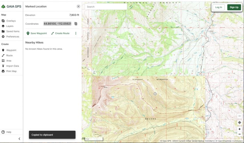
I like Gaia. Wish it had land ownership. It is not without it's bugs. I just reported this....
It does have ownership layers available. Or did you mean something different from what is shown below?

51720382684_0c94215963_o.jpg
 
onX definitely has some mislabeled state property (private marked as state) in my neck of the woods.
 
There are also instances where fences are up and OnX shows a different property line, but the fence is actually not where it should be. Original purchasers may have fenced an area and that may or may not be the actual property line, only way to tell would be to re-survey. But then how much would it cost to refence the entire area, especially if it's a large chunk of land. Last year I was trying to get better info on some roads in CO, got passed around to several different people, made a full circle once, and finally got my answers. It does take effort, but always better to confirm what you find on something like OnX before you go out in the field. Here in Texas, OnX still shows our property under the previous owners. Property line is pretty much right on though.
 
Back
Top