RobG
Well-known member
I don't have much time today. Basically correct, but a couple things:Can we agree on a set of facts present in this land swap? For instance, as I see it:
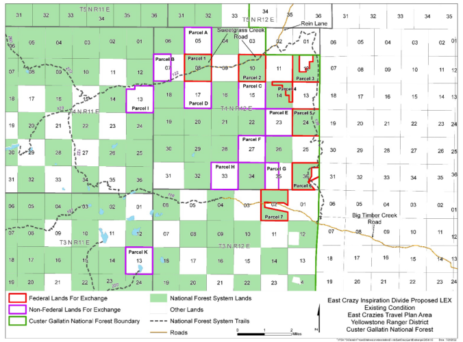
1. The land swap will consolidate both public and private holdings in the area, removing the "checkerboard" nature currently existing.
2. The land swap will be "acre for acre", the same amount of land will exchange between public and private holdings
3. The "quality" of the exchanged lands is up for debate, some further data gathering will help make this more clear (fisheries and wetland data) hopefully
4. The currently "checkerboard" public land has little or no public recreation value as there is no clear (or objectively legal) way to access said sections. The value of the land to the FS has not been evident (at least to me) as far as harvestable timber, etc. One could argue (and I would be one to make the argument) that the checkerboard nature is much more beneficial to the private landowners in the area as they have the ability to utilize those sections of public land for business purposes (cattle grazing, outfitting) without pressure from public access.
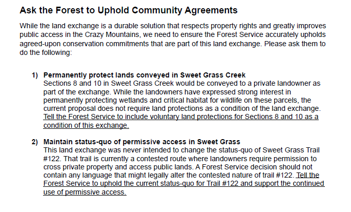
5. The main sticking point is access from Sweetgrass Cr. USFS does not want to fight for this access (historical use trail or road) within the parameters of the land swap, as they believe this will jeopardize the private landowner's involvement in it. BHA and other parties would be behind the swap if the access issue was cleared up as a process of the swap.
6. The land access issue (historical use trail or road) could be addressed after the swap or at any time by any entity with the funds to pursue it legally (?, this is how I understand it)
Am I missing anything or have anything just plain wrong?
2) It isn't acre-per-acre. For this swap the public gets quite a few more acres than the private landowners do. The way land swaps work is the appraised monetary value of the respective lands are supposed to be roughly equal. Landowners can make up a certain percentage of mismatch with cash. I have a specific concern about them doing this in S14.
3) I think the quality of the land for habitat is known, although I think the quality of the Sweet Grass is overstated. Sweet Grass Creek is dry most of the year on the public sections, and there is a road that goes through them. There is even a residence beyond the first section of public land, etc.
I also think the value of the lower elevation sections are overstated, mostly because we can't access them. I've been on the southernmost section, and it is not wintering range, and it's comparable to what we'd get. The next two sections up are reportedly better, but the private land to the east support good populations of elk even during bow season, which is why they outfit it.
5) Supposedly BHA's problem is with the Sweet Grass trail access, but they keep bringing up other issues, such as Yellowstone Club's involvement...
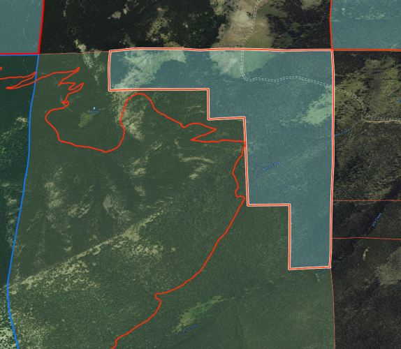
6) That was supposed to be the deal. However, the Forest Service changed the original proposal so that the land access issue can't be settled after the swap. That is a deal breaker for me, and I think most other groups. Other issues are weak conservation easement requirements and the loss of part of S14.


