Caribou Gear Tarp

goHUNT Mobile Maps comments sought in this thread

Dave; do you guys have any plans to add a modified roadless layer? I realize that ONX may have some sort of a patent restriction on this, but there should be some ways around it and, IMHO, ways to improve it and be more useful. I frequently use ONX to check the purple to white areas for reference in e-scouting.
If not, then what modifications are on your priority list?
Jag, excellent question.

We do have plans for a roadless layer, and we have talked about this internally at length on how to best approach it. It is lower on the priority list at the moment. Currently, we are focused on increasing the coverage/accuracy/UI of our existing layers and expanding our product line for the 50 state coverage. We have been diligently working on an aggressive project to increase road coverage in the west and the roadless layer is very much dependant on that. So, a Roadless layer is still a priority but is also dependant on some other projects being completed first. Additionally, we have a new topo base map coming out that we developed that I think everyone is going to really enjoy! This should be available in the next few weeks. As a topo geek, I have fallen in love with it!
 
  • Like
Reactions: JAG
One of the things I'd love to see is the ability to use the layers from the app while using the filtering. It would make researching for your applications way easier.
 
  • Like
Reactions: JAG
Jag, excellent question.

We do have plans for a roadless layer, and we have talked about this internally at length on how to best approach it. It is lower on the priority list at the moment. Currently, we are focused on increasing the coverage/accuracy/UI of our existing layers and expanding our product line for the 50 state coverage. We have been diligently working on an aggressive project to increase road coverage in the west and the roadless layer is very much dependant on that. So, a Roadless layer is still a priority but is also dependant on some other projects being completed first. Additionally, we have a new topo base map coming out that we developed that I think everyone is going to really enjoy! This should be available in the next few weeks. As a topo geek, I have fallen in love with it!
Love the new topo base map! It's very crisp and quick to adjust as you zoom in and out.
 
One of the things I'd love to see is the ability to use the layers from the app while using the filtering. It would make researching for your applications way easier.
I'm not a computer guy, on the surface, this seems simple, but substituting the Maps app with the generic one in filtering might be a major undertaking.

I like this idea, but for now, use two windows to do this.
 
Mobile gripe -- I downloaded some offline maps and took it for a test drive along the southern border and the app felt broken for most of the hunt. I couldn't lock onto my location, couldn't load the map, it was buggy and weird until I found a hill where I could get signal and even then it was spotty. I default to blaming the user, it was likely something I did but it was a brand new phone and everything else seemed to work normally. I didn't figure out why I had the issues but I ended up reinstalling, and I haven't been back out to retest. I'll try it again, but the first trip was not particularly successful. Is there some kind of problem with being near international borders?

Side gripe - Especially on the desktop, I like having access to all the states, but can I save some as favorites, or select a home state? I spend 99% of my time looking at layers in my home state, and I'm always having to scroll through the folder structure to get to what I'm working on. Can I just bin the others so that they are out of the way?

Thanks

Hey Chama Grande,

I'm going to shoot you a DM, lets talk more on the issues for sure.

I like the feedback on the side gripe, and I agree! I just passed this along to the team!
 
Stupid question but is there a way to save my tracks that I’m just not figuring out? I’ve been trying to do some comparisons to OnX and for the life of me haven’t figured out how to save training hikes.
 
Stupid question but is there a way to save my tracks that I’m just not figuring out? I’ve been trying to do some comparisons to OnX and for the life of me haven’t figured out how to save training hikes.
Hey clharr,

I'll run through the whole flow for anyone else who may be having the same issues.
- Open the app
- Hit the + button on the right hand side of the screen
- Select "Record Track"
- Once ready to begin the track, select "Start"
- You can leave the tracking tray active, or hit the x in the right hand corner to minimize it so you can see the map.
- When you are ready to end the track simply click "Finish"
- If you had previously minimized the tracking screen you will need to hit the + button again select "Record Track" and then you can click on Finish.

Please let me know if this helps, thank you!
Thank you Dave. Is there a way to save that data and retrieve it later? For example I hike in to a spot during day light and want to save my route via the map so I can find my way back out or in when it’s dark.
 
Thank you Dave. Is there a way to save that data and retrieve it later? For example I hike in to a spot during day light and want to save my route via the map so I can find my way back out or in when it’s dark.
Yes, definitely. Once you've hit finished in that flow the track will be saved into your content folder and you can view it, and it's associated data, at any time!
 
Yes, definitely. Once you've hit finished in that flow the track will be saved into your content folder and you can view it, and it's associated data, at any time!
Interesting, mine isn’t doing that. I even just tried it twice. Maybe I’ll uninstall then reinstall the app to see if that works.

My waypoints are saved but not the tracks.
 
Interesting, mine isn’t doing that. I even just tried it twice. Maybe I’ll uninstall then reinstall the app to see if that works.

My waypoints are saved but not the tracks.
After clicking finish you are taken to the edit screen where you can edit the details on the track - color, name, etc... Are you also clicking save on that screen?
 
After clicking finish you are taken to the edit screen where you can edit the details on the track - color, name, etc... Are you also clicking save on that screen?
Definitely a bug on my end somehow then as whenever I click finish the tracking box just goes away, it’s never taken me to an edit screen. I’ve even deleted and reinstalled the app today. I’ll contact tech support next week when I have some time.
 
Definitely a bug on my end somehow then as whenever I click finish the tracking box just goes away, it’s never taken me to an edit screen. I’ve even deleted and reinstalled the app today. I’ll contact tech support next week when I have some time.
Sure thing! I'll likely be the one emailing you via that as well. In the end, you and I may need to jump on a quick call. Feel free to DM me here, or email me directly at [email protected] when you have time to connect!
 
I’ve tried so hard to love this mapping software but have been ravaged by issues. Just got back from a trip and went to view my saved tracks…. Gone. Then went to view some previous trips tracks. Guess what? Gone. Extremely important information gone. Waypoints are the only thing that seems to actually save
 
I’ve tried so hard to love this mapping software but have been ravaged by issues. Just got back from a trip and went to view my saved tracks…. Gone. Then went to view some previous trips tracks. Guess what? Gone. Extremely important information gone. Waypoints are the only thing that seems to actually save
Hey kelly14,

I just got your email and have reached out the to team. Once I get word on this I will hit you back personally and will also post a response here for other members and clarity. Thank you!
 
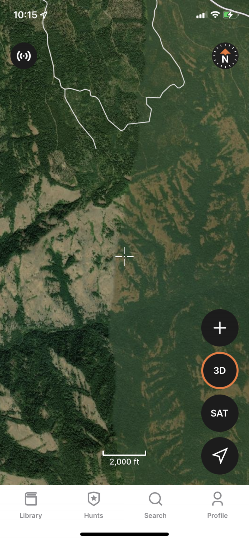
Map supplier has poor imagery where I hunt, you can see the transition from good to bad in the screenshot (NE Oregon). Also missing a bunch of TMA's in NE Oregon.

IMG_4556.PNG
 
Map supplier has poor imagery where I hunt, you can see the transition from good to bad in the screenshot (NE Oregon). Also missing a bunch of TMA's in NE Oregon.

View attachment 222730
WapitiBob,
Thank you for the screenshot, I will definitely pass that along to the team. I have also pinged our GIS department to check into the missing TMA's and update where needed. Thank you!
 
Sure thing! I'll likely be the one emailing you via that as well. In the end, you and I may need to jump on a quick call. Feel free to DM me here, or email me directly at [email protected] when you have time to connect!
Just wanted to check back in after being insanely busy with work and daddy duty.

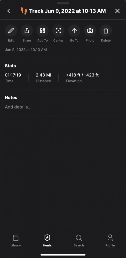
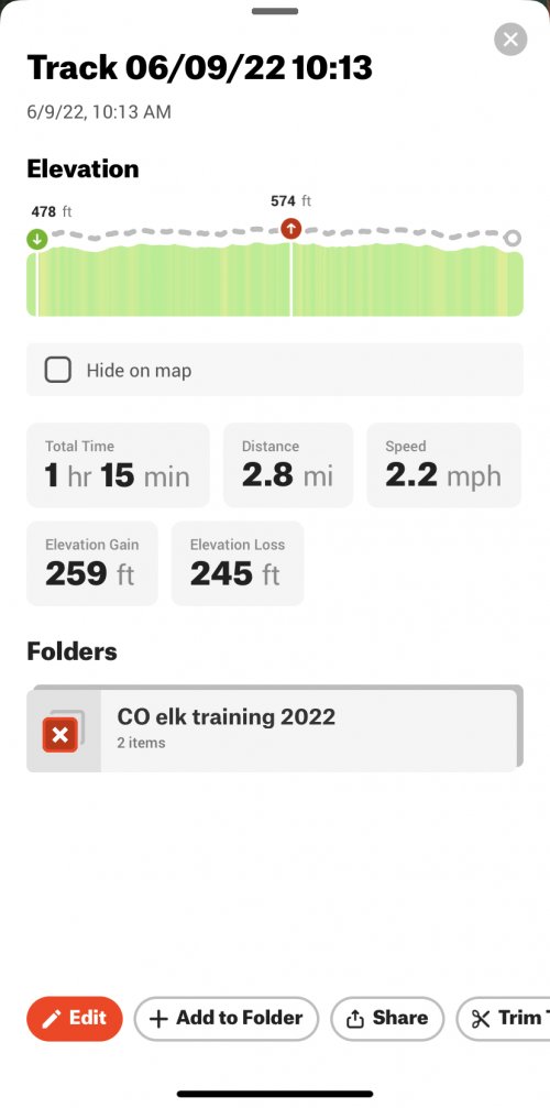
Went out on a very quick hike yesterday and my tracking is now working correctly and letting me save it. Not sure what the original issue was bud glad it’s gone. I ran the OnX track at the same time and while it ran and saved my distance it showed me being in Colorado the whole time…..I wasn’t even close. Lol

The real interesting thing was the differences in distance and elevation the two systems recorded. Not sure which is more accurate and how much it really matters, but here are the screen shots.
 

Attachments

  • E57759CA-618A-4706-9150-B7D2E52870B6.jpeg
    E57759CA-618A-4706-9150-B7D2E52870B6.jpeg
    149.2 KB · Views: 10
  • 2E30BFF7-7A8F-4B42-8169-2D4F27B1F191.jpeg
    2E30BFF7-7A8F-4B42-8169-2D4F27B1F191.jpeg
    259.4 KB · Views: 10

Forum statistics

Threads
113,636
Messages
2,027,733
Members
36,258
Latest member
Scotpip
Back
Top