Why I prefer GaiaGPS over ONX

I used locus pro at my last job and absolutely love it.
Great topo maps for an entire state/country that don't take forever to download. Could easily import KMLs from Google earth. I much prefer it over Gaia, onx, etc for navigating.

No public lands layer.
 
Another question for the Gaia folks. Are you able to import and export waypoints/shapefiles/etc.? I toyed around with GoHunt Maps on trial earlier this fall and if I recall correct, getting all my info into GoHunt from OnX was seamless, except the fact that the points come across as a default symbol and color.
Yes, I have imported a .shp file into Gaia, although I've never tried to import waypoints. This was a few years ago; I haven't tried to import files lately.
 
I have been on the fence, but you probably pushed me over. Going to let OnX go, since I can get almost everything from Gaia (can't find burn scars). Have been using Gaia for some seven years, a great way to convert your cell phone to a very good GPS.

David
NM
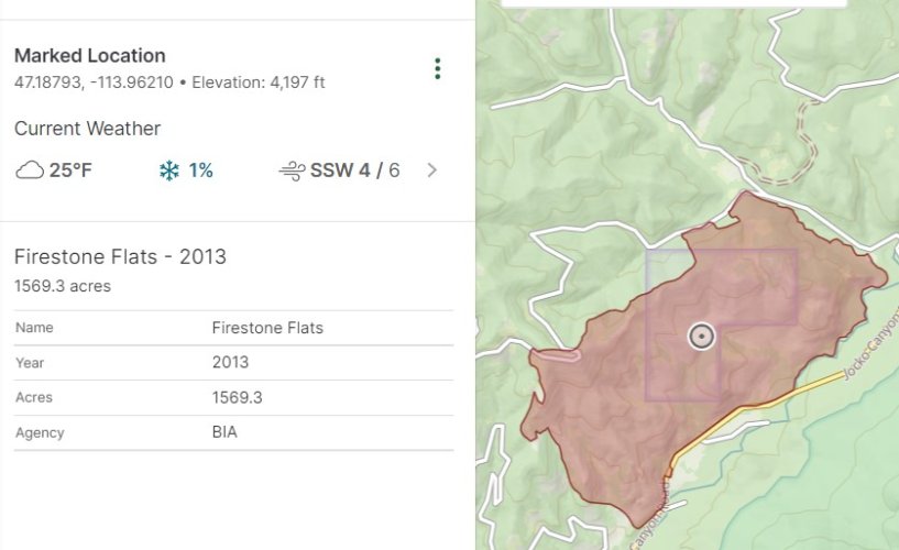
GaiGPS has many layers including fire perimeters. I like that they use different colors for historic versus 2022 wildfires.
Wilfire_GaiaGPS.jpg
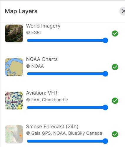
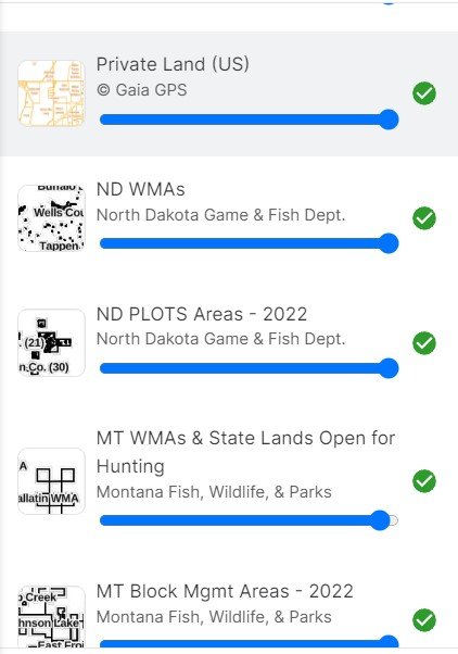
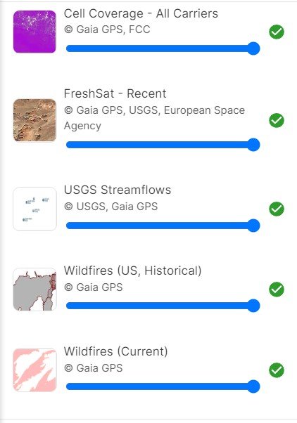
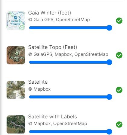
Here are some other GaiGPS layers I find useful:


Gaia_Layers1.jpg
Gaia_Layers2.jpg
Gaia_Layers3.jpg
Gaia_Layers4.jpg
 
GaiGPS has many layers including fire perimeters. I like that they use different colors for historic versus 2022 wildfires.
View attachment 254446
Here are some other GaiGPS layers I find useful:


View attachment 254450
View attachment 254449
View attachment 254448
View attachment 254447
Well, I consider myself educated. From dumber to just dumb, it is an upward progression. Gaia it is (I find it updates more quickly and more accurately when I am tracking on it).

David
NM
 
Interesting application, @AlaskaHunter . I'm not familiar with Gaia. Would be a quality addition / secondary evaluation for e-scouting and terrain navigation, depending on the $.

My use with OnX is mostly based on edumacation set with something that works pretty darn good and the adage, Gov't fixes what works - Don't be like Gov't.
Other aspect with OnX is their service. I've called / emailed them on a few occasions and they are realistic, not script driven. Their customer service is top notch.
Top that with their alliance with public land /public hand idealism - is a bonus.
 
Bringing this back up. Looking at switching from OnX to something else.


I initially thought about GoHunt, for obvious reasons, but the cost and benefits didn't seem to pencil. Then I remembered this thread. Any updates? People still loving Gaia? They fix the download maps issue? They claim to update ownership pretty frequently which I like when using for work.
 
Another important feature that GAIA has that Onx lacks is the abikity to share waypoints/tracks etc wirelessly from one phone to another using airdrop/bluetooth etc with mo cell signal. Want to share waypoints etc with another onx user whenoff the grid, ain’t possible.

Also a lot easier to manually generate a new waypoint for a known location in Gaia and also to edit a waypoint.
 
Bringing this back up. Looking at switching from OnX to something else.


I initially thought about GoHunt, for obvious reasons, but the cost and benefits didn't seem to pencil. Then I remembered this thread. Any updates? People still loving Gaia? They fix the download maps issue? They claim to update ownership pretty frequently which I like when using for work.
I think that HQ post is intentionally a bit misleading. The public is “locked out” of those parcels due to the land ownership patterns onX highlighted. The outfitter’s special use permit likely doesn’t affect the public’s ability to access or hunt those parcels.
 
For years I built my own maps in GIS software and used them in Avenza. A couple years ago I went to the Dark Side ( OnX ) out of ease of use. It's a good product in its functionality but Jesus the symbology sucks. I mean really, the roads and stuff, the way the ownership and BMA polys and their fills don't fade out with zoomed in scale dependency. I am often struggling to discern what I am looking at. I don't find it intuitive.


I'll be looking into Gaia. I'm always looking for an excuse to abandon OnX.
 
I think that HQ post is intentionally a bit misleading. The public is “locked out” of those parcels due to the land ownership patterns onX highlighted. The outfitter’s special use permit likely doesn’t affect the public’s ability to access or hunt those parcels.
Yeah, it's not like he owns it out right. But one of the comments rings pretty true for me.
Screenshot_20231020_070222_Instagram.jpg

Not that others probably aren't doing this too but OnX has made a big deal about public land access. Then to go and buy into landlocked public lands for private outfitting use... Well, to say that leaves a bad taste in my mouth is an understatement
 
For years I built my own maps in GIS software and used them in Avenza. A couple years ago I went to the Dark Side ( OnX ) out of ease of use. It's a good product in its functionality but Jesus the symbology sucks. I mean really, the roads and stuff, the way the ownership and BMA polys and their fills don't fade out with zoomed in scale dependency. I am often struggling to discern what I am looking at. I don't find it intuitive.


I'll be looking into Gaia. I'm always looking for an excuse to abandon OnX.
Yeah going from Arc products to OnX is like having to use a toy phone of your kids. I am always thinking of options I'd like with symbology/attributes when I'm using OnX, but it is kinda nice to keep it simple sometimes. Some options for more complex attributing and symbology would be nice though.
 
For years I built my own maps in GIS software and used them in Avenza. A couple years ago I went to the Dark Side ( OnX ) out of ease of use. It's a good product in its functionality but Jesus the symbology sucks. I mean really, the roads and stuff, the way the ownership and BMA polys and their fills don't fade out with zoomed in scale dependency. I am often struggling to discern what I am looking at. I don't find it intuitive.


I'll be looking into Gaia. I'm always looking for an excuse to abandon OnX.
I started building my own in Google Earth, OnX was an easy upgrade over that. Road stuff kills me, and trails are surprisingly inaccurate
 
I currently have OnX, GoHunt, and Gaia...

OnX has the best satellite imagery by me (I requested they switch source maps in my area as it was extremely blurry. They did switch it and it's been great. They also have lots of data, like oak forest areas, and such.

GoHunt clearly has the better draw odds and a much smoother web app than OnX does.

Gaia has a lot of nice features.

I wish we could combine all the best features into 1 app.
 
A majority of OnX data is free data especially in the west. Systems like Cadastral in MT is tragically inaccurate for mapping needs and the trails layers often come from the land management agencies which are worse than the ownership layer. I bet I've attempted to hike trails that didn't exist or were so far off that I was in the wrong location a dozen times this year thanks to FS trail layers.

I'm lazy so OnX usually gets my $ though the last time I tried to use a coupon on my existing account it didn't work (supposedly most are for new accounts only). I need to export my points so I don't lose them and maybe try Gaia.
 
my-bad.gif


New complaint, I had to uninstall and reinstall the app to get the update. It didn't let me do an automatic update which was apparently bogging down mine pretty bad. Seems to work better now.
 
Last edited:
Hate the GoHunt maps compared to OnX. Definitely switching when it renews. It's so slow to load information whether on wifi or cell unless you have it downloaded. Forget changing between topo and satellite. I have to force close the app and restart it again to see that change.
Might want to uninstall and reinstall the app. I haven't had this issue at all. I can flip between topo and satellite seamlessly...
 
I use OnX and it would be hard to switch simply because it is very convenient to send stuff back and forth with my hunting friends who all use OnX.

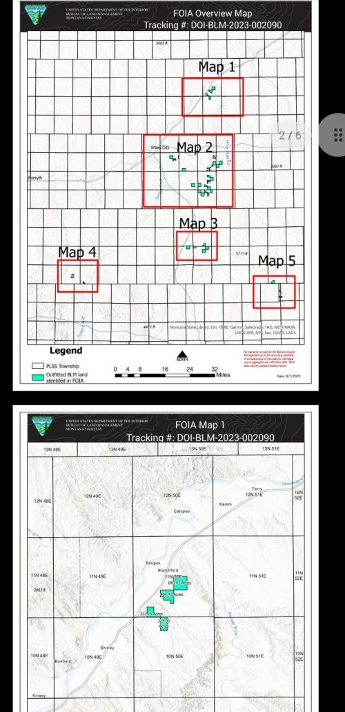
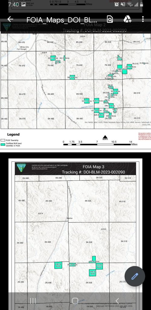
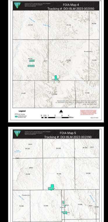
Here is a thread on rokslide titled 'OnX hypocrisy' about Eric Siegfried purchasing property around land-locked public and operating an outfitting company on those landlocked pieces.

I have no idea what his intentions are with that land there is only speculation. It'll be very ironic if they remain off-limit to the public though
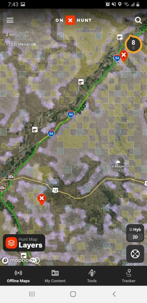
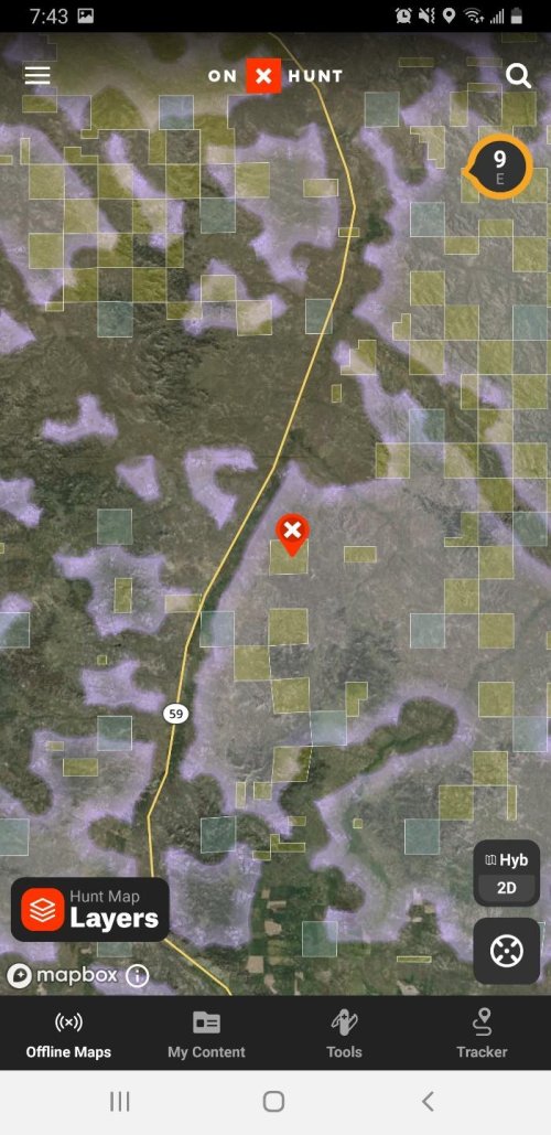
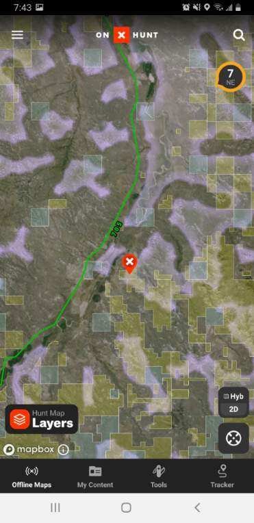
Resized_Screenshot_20231018-194338_onX_Hunt.jpgResized_Screenshot_20231018-194338_onX_Hunt.jpgResized_Screenshot_20231018-194328_onX_Hunt.jpgResized_Screenshot_20231018-194308_onX_Hunt.jpgResized_Screenshot_20231018-194013_Drive.jpgResized_Screenshot_20231018-194005_Drive.jpgResized_Screenshot_20231018-193958_Drive.jpg
 
I use OnX and it would be hard to switch simply because it is very convenient to send stuff back and forth with my hunting friends who all use OnX.

Here is a thread on rokslide titled 'OnX hypocrisy' about Eric Siegfried purchasing property around land-locked public and operating an outfitting company on those landlocked pieces.

I have no idea what his intentions are with that land there is only speculation. It'll be very ironic if they remain off-limit to the public though
View attachment 298000View attachment 298000View attachment 298001View attachment 298002View attachment 298003View attachment 298004View attachment 298005
Seems like a hell of a reason to dump OnX immediately if this is true.
 
MTNTOUGH - Use promo code RANDY for 30 days free

Latest posts

Forum statistics

Threads
114,410
Messages
2,056,401
Members
36,587
Latest member
WillF
Back
Top