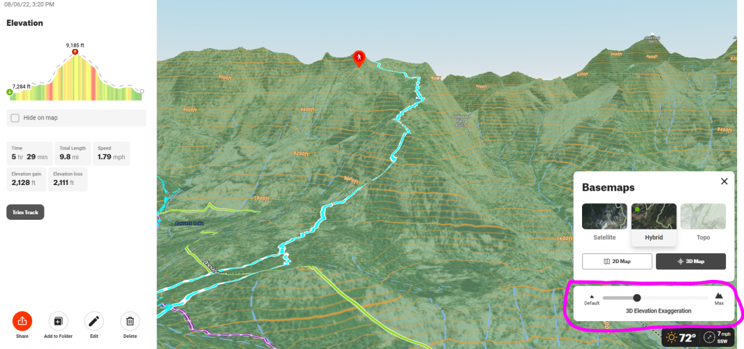
TOPO exaggeration.

2rocky

Well-known member
Joined
Jul 23, 2010
Messages
5,136
Was looking at a path I rode this weekend, and really feel like to be good information....Or MEANINGFUL when you scout out an area SOME degree of Vertical exaggeration is necessary to convey the actual steepness. To my eye, this level of exaggeration is about equivalent to what I see with boots on the ground...
1659997959244.png
 
Last edited:
Super cool feature, now you’ve got me curious. Now I know what I’m doing when my daughters go to bed tonight!
 
i really like this feature for lower elevation / flatter land hunting. it can be tough planning out glassing spots out on the plains, so this feature works really well.
 
I mean...2,000' in 5 miles is a good workout, but that graphic makes it look like you climbed Pikes Peak, lol. Cool feature, though. Is that OnX?
 

Latest posts

Forum statistics

Threads
113,637
Messages
2,027,780
Members
36,259
Latest member
Zaner
Back
Top