Use Promo Code Randy for 20% off OutdoorClass

OnX map question re: roads (specifically MT)

I agree with the GIS sites. Very helpful. I don’t know if this is useful to some folks that hunt Idaho, but check out idahotrails.gov. Shows type of trail, vehicle restrictions and dates the are open. I tried to put them all on my GPS but it was a bit too much. I haven’t looked to see if there is a similar site for Montana.
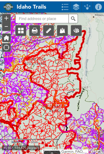
FEC931A7-3C08-4150-BDD2-F92DA96E0A72.jpeg
 
Last edited:
A great place to start is the county GIS department, I also highly recommend calling the county maintenance department and asking how far up X road they grade and plow.
Ha, I was just going to mention asking the county about maintenance. For the South Crazy Mountain exchange MTGomer did that and it eventually led to the discovery of a written easement that the Forest Service didn't know existed - which was a very big deal.

In that case you could find the map by Googling "Park County MT road maintenance" but if you can't find the info online you can also call them. Probably even more useful is calling the Forest Service or whoever manages the land. They usually know the inside scoop.

Here's the Park County website maintenance map. http://www.parkcounty.org/Government-Departments/Roads-Bridges/
 

Latest posts

Forum statistics

Threads
114,245
Messages
2,049,410
Members
36,525
Latest member
TimelessTim
Back
Top