OnX Forest service trails through private

Luke_with_a_lab

Well-known member
Joined
Mar 4, 2019
Messages
402
Location
Montucky
Hey all,

I was hoping you guys could help clarify some confusion. I'm having trouble with trying to figure out if "forest service trails" onx shows are actually indeed open for use. I'm looking at an area that has a fair amount of checkerboard (not the crazies) and onx shows a few different forest service trails going through the checkerboard. If these trails actually are open it would provide access to a fair amount of the public checkerboard. I also looked on the forest service interactive topo map online, again here the trails also appear.

Have you guys found that the trails onx shows going through private land are usually open? Or are they only open if there is an easement symbol there?

Thanks
 
are you looking at the forest service trails using the MVUM layer?

cross referencing the forest service official MVUM map?

if it's not on either of those and it's not a county road than there is likely no easement.
 
in other words, if the roads you are looking at are purple on onx then you should be good to go provided they are open the time of year you wanna go there.
 
gosh. i'm realizing just now you were talking about trails, not roads.

trails can be sticky. look at the forest service page for the trail head itself for the trails you are looking at and that can help verify it has easement.
 
Man, it just depends. OnX for the most part, gets their data from the public agencies, and so many agencies are just skating by til a trail or road is challenged.

I know example in the Bull Mtns south of Boulder where this could be the case. Or where the trails are only applicable during hunting season because they have been incorporated into some access program via FWP that I cannot recall right now.

Interesting. I guess I'll have to do some more digging. Its really not too feasible to go there in person right now due to snow. You'd think onX would want the trail data they show to be accurate.
 
I know trails through private land that OnX shows that are perfectly legal and get used every season. I know just as many that show up on OnX and are not legal for the public to use. I’d contact the forest service to be safe.
 
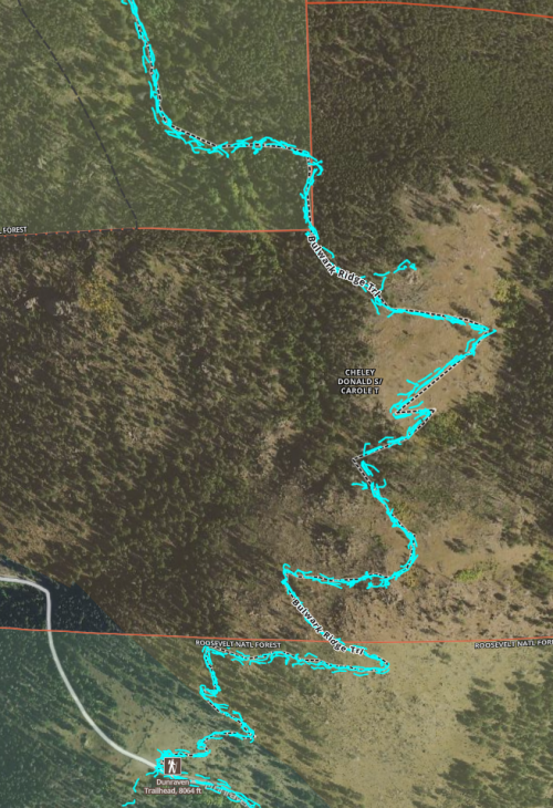
here is a trail, marked on onX, that crosses private land and it is for sure open to the public. So if you see something like this in the area you are looking at, it certainly would be something worth checking out.

1647270299539.png
 
Onx MUVM layer had an update in the last few months and is now showing tons of closed roads/trails as open to high clearance 4x4 vehicles. The Idaho Panhandle and Clearwater MVUM layer had been fairly accurate IME but they added some new data that really messed with it. Some of them are old logging roads that are grown in and blocked/gated, or roads open to ATVs or dirt bikes but not full sized vehicles. I noticed it for some NF roads/trails MT, and also BLM roads in MT and WY. I sent some messages and they said they would look into it, but I haven't seen any corrections yet.
 

Forum statistics

Threads
113,671
Messages
2,029,144
Members
36,278
Latest member
votzemt
Back
Top