Irrelevant
Well-known member
Dude, F that arc pro BS! Everything I get in there I spend more time googling how to do something than actually working and go back to arcmap.
Follow along with the video below to see how to install our site as a web app on your home screen.
Note: This feature may not be available in some browsers.
Dude, F that arc pro BS! Everything I get in there I spend more time googling how to do something than actually working and go back to arcmap.
AgreedSince we have moved on from cheese to underwear, Duluth Trading buck naked or First Lite merino are the only way to fly.
Ben, if you really want the boys to run free, I will make you a heck of a deal on a very lightly used Mountain Hardwear Elkommando Kilt my wife and daughter bought for me.I tell you what, I've been going commando for over 30 years, and it's nice in the summer, when stuff gets...sticky.
Winter is a different story, but for fellas dealing with ample masculinity, sometimes letting the boys run free is necessary.
100%Dude, F that arc pro BS! Everything I get in there I spend more time googling how to do something than actually working and go back to arcmap.
100%
Also:
Arc Users: "Hey could you make a 64 bit program, my computer has 8GB of ram and I have trouble with large datasets"
ERSI: "Sure thing"
8 years later
ESRI: "So here it is... shiny right, and we moved all the buttons, and *dramatic pause* because it's a 64 bit program it can handle a lot more data so we re-designed the way the program interacts with databases so there are more "features"...
Arc Users: "So wait, you got rid of the editing session so now it looks back to the database EVERY time I click"
ESRI: "Yeah exactly, look at this cool widget"
Arc Users: "So if I copy paste in the attribute table now it crashes the program even with 40GB of ram"
ERSI: "Well now there is a faster way to..."
Arc Users:

Why do 1 ft contours instead of hillshade?Let us geek out.
Agree with you on all accounts. I resisted for years, but I have drank the ESRI Kool-Aid and am all in on Pro now.
For raster processing and analysis it's just better. Also capable of way more cartographically. 10.8 came out a few months ago, and there will never be a 10.9.
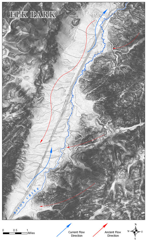
I made this map of Elk Park a while back. Those are 1 foot contours. This dataset melted ArcMap, but in Pro I could set the line width to .1, and it came out nicely. It helps to have 64 GB of RAM.
View attachment 171013
labelling.... f labeling. Also F all templates.... and like why is changing the color of a line now a geoprocessing function that requires the program to think...
and I literally did not think you could have make the symbology GUI worse but they some how actually did.
Why do 1 ft contours instead of hillshade?
Let us geek out.
Agree with you on all accounts. I resisted for years, but I have drank the ESRI Kool-Aid and am all in on Pro now.
For raster processing and analysis it's just better. Also capable of way more cartographically. 10.8 came out a few months ago, and there will never be a 10.9.
I made this map of Elk Park a while back. Those are 1 foot contours. This dataset melted ArcMap, but in Pro I could set the line width to .1, and it came out nicely. It helps to have 64 GB of RAM.

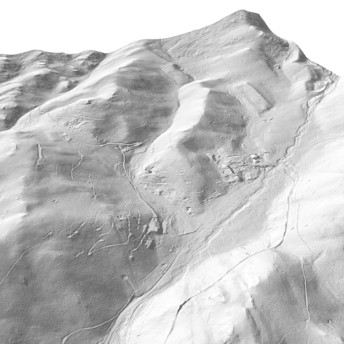
I like it.... has an oldschool kinda vibe or something, for whatever reason hillshades can look really computer generated.Just thought it looked cooler - almost as if it had been drawn in pencil, or at least was a style of map I'd never seen before. The county in which I live has county-wide LiDAR coverage, and I like to experiment. I feel it gives you a good idea of just how lumpy some of that country is.
No @POST #210

This is my heart rate after a 10 mile run@Nameless Range and @neffa3 I haven't figured out how to print a good 3D map, but it's cool as a visualization tool.
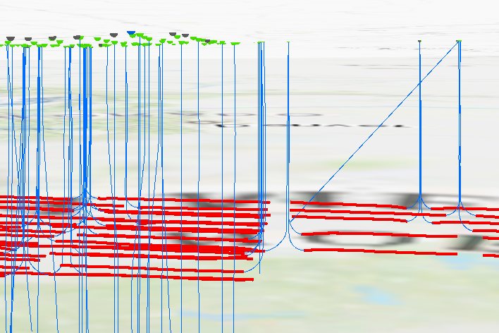
Drilled wells, with the perforated interval highlighted.
View attachment 171019
@Nameless Range and @neffa3 I haven't figured out how to print a good 3D map, but it's cool as a visualization tool.
Drilled wells, with the perforated interval highlighted.
View attachment 171019

I have to disagree those people have already been wearing them for the last year and what's it done nothing. Not to mention we buckled our economy to fight a virus that has a lower kill rate than the flu did in 2019. Flu was 7.1% COVID has hovered at 2.2-2.75% They're just testing the water on how much they can get away with and conditioning our children that "don't worry the government will take care of you" There was a government in the 50's and 60's that did the same oh what was the name of it.... oh ya SOVIET UNIONI think you guys are really reading into this way too much. The intention is to have people follow cdc guidelines in federal property. Think about the federal properties where thousands of people work every day.