Kenetrek Boots

E-Scouting Gate or Cattle Guard?

Runnin_Chupacabra

Well-known member
Joined
Mar 10, 2020
Messages
484
Location
Central Coast, CA
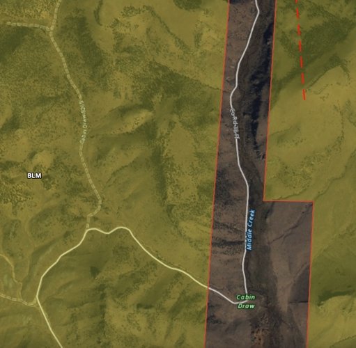
I'm getting ready for my first out of state hunt in CO and have been doing a lot of E-Scouting. I'm having trouble telling if something is a cattle guard or a gate on google earth and OnX. These roads tend to dance along the boarder of public and pieces of private. Wasn't sure if a land owner would put a gate up on a section of the road that jumps on to private land for a short portion before continuing on to the vast amount of public land beyond. Already have put in hours upon hours of e-scouting my unit and would hate to get there and see there is a gate(s) on the areas I've picked out to hunt. Thanks!
 
Is it a public road? If it's a public road, you should be fine. Otherwise, maybe to get ahold of the game warden there and ask. But yes, a landowner might absolutely have a gate there.

E-scouting is great but I've learned over and over again that it is really hard to know the answers to lots of questions like that until you get there and see it with your own eyes.
It is a public road. Maps show it as a county road that starts on BLM as it comes off the highway, winds through private for a few miles then ends up on public farther north out of the attached photo.Image 12-10-20 at 9.09 PM.jpg
 
Those look like guards to me and I’ve read hiking reports about the trail to the north of there and it seems people drive right to the trailhead.
Call the forest service office or CPW for that county and they should be able to answer it for certain.
 
Hit the county website for a county road map. There are plenty of times when a county road ends, but the road continues on through private and back into public, and the road is gated at the end of the "county" road. County road maps should indicate where the public ROW ends.

I've found GE to have better resolution than onX. Might be helpful to determine guard vs gate.
 
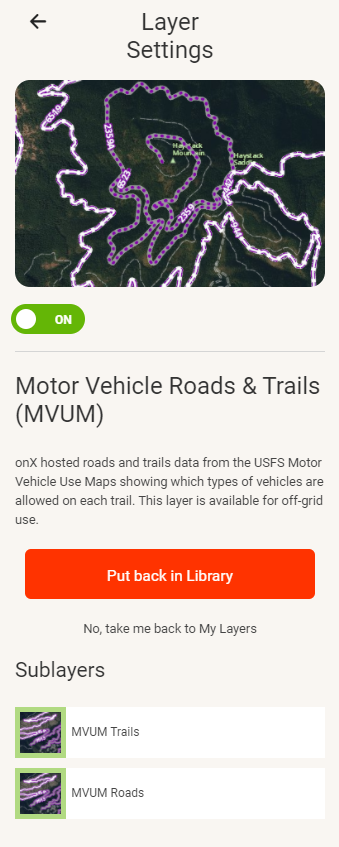
MVUM maps are pretty reliable for USFS.

On-X has a layer

1607709697836.png

I don't know for BLM though.

Many times in a case like the picture you posed if you look and see tracks skirting the property line there is likely a locked gate.
 
You might want to try the State website as well, it's called COTREX, set up the user name and login and then you can see the roads and trails, it shows closures.
It's a great site for us here in Colorado, toggle between map and satellite view.
 
When Biden was Vice-President he asked if the government really needed these "Cattle Guards" on the Government payrolls. The idiot thought they were armed guards scattered all over the west. He wanted to fire them. The ranchers should protect their own cattle.
Love it when people call out idiots or just shine a light on themselves.;)
 
You might want to try the State website as well, it's called COTREX, set up the user name and login and then you can see the roads and trails, it shows closures.
It's a great site for us here in Colorado, toggle between map and satellite view.
Thanks! That looks like it can be a great resource!

Also, welcome to Hunt Talk!
 
Back
Top