Flatlander3
Active member
Ive heard you can buy BLM maps from the blm offices. Are these any different than the Quad maps? Show BLM roads better than just dashed lines like quad maps? Thanks
Follow along with the video below to see how to install our site as a web app on your home screen.
Note: This feature may not be available in some browsers.

 plicmapcenter.org

Thanks for the information! I am mainly interested in roads or easements that they may show. I work in a mapping field and consider myself a mapping expert. I made a map for the unit I plan to hunt, but wondering if there are any extras on maps you buy from the BLM that you can't get on other maps.Not sure your experience with various mapping products, physical,or electronic so will hit some basics...
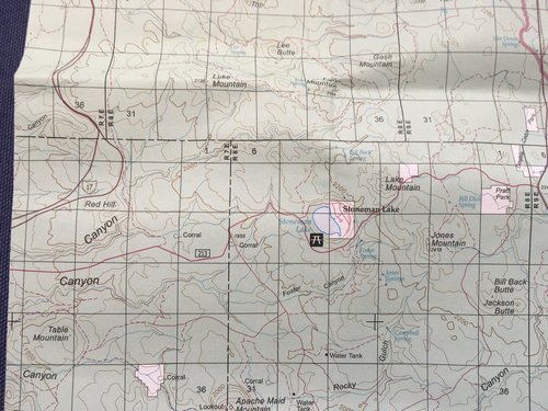
Short answer, yes you can buy BLM maps at local office, and many other outlets....roads layer can have advantages of what is pri ted on usgs maps but not always..and scale is 1:100k instead of 1:24k so very different level of detail.
BLM maps are VERY different, and for most hunts around the west for me, better than usgs 1:24000 “quad” maps, that frankly can be too detailed and too voluminous for a large hunt area to deal with. presume by quad map you mean he usgs paper maps. so that is my comparison.
I used to assemble tons of usgs paper maps for hunts and used the heck out of them but that is replaced with same level of detail now available via phone and gps software. Onx, earthmate, and garmin gps units. But still always get paper BLM maps and Forest service for hunt areas I draaw so I have good paper maps simce much better for looking over a broad area to strategize before and during a hunt.
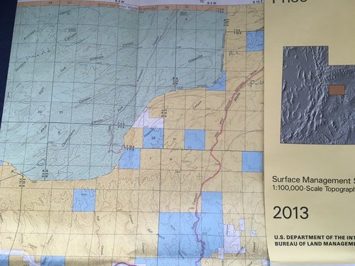
The are a variety of BLM map types, the one you want for wesetern hunts is almost invatiably the Surface Management map for area of interest. has land status/ownership color coding, good road/trail coverage, topography etc.
As I draw hunts in various states for lands I will see for first time I usually just buy from a central distributor versus local offices, and get in the mail right after I draw.
This one is great

Public Lands Interpretive Association
The Public Lands Interpretive Association inspires and educates the public about the natural and cultural heritage resources of America’s public lands. Your purchases support projects on public lands. Your dollars will directly enhance your experience and help preserve these special places for...plicmapcenter.org
and you can shop for blm maps and forstest service maps even by hunt species and hunting unit for each state. plug in your hunt and see/select any or all maps overlapping hunt area. Hard to beat. Pay a smidge more than if order from a local blm office but so what...
BLM is now even making available electronic georeferenced maps you can download and use on a phone

Maps | Bureau of Land Management
Maps From the White Mountains in Alaska to the Jupiter Inlet Lighthouse in Florida, map and geospatial products inform our management decisions. A growing selection of those maps are available for your public lands adventures and business. Explore BLM lands with the National Data map viewer...www.blm.gov
What area are you interested in? And for what activity, that can help sort out what may be optimal...
My 2 cents.
Just a guess, but if you have ownership on the map you made I'm guessing there is nothing extra you'll gain from a BLM map. IMO, ownership is their biggest asset.Thanks for the information! I am mainly interested in roads or easements that they may show. I work in a mapping field and consider myself a mapping expert. I made a map for the unit I plan to hunt, but wondering if there are any extras on maps you buy from the BLM that you can't get on other maps.
I saw the geo pdfs they provide. Are those Similar to the ones you buy?
Reply
yes and no. Some are some are not.Thanks for the information! I am mainly interested in roads or easements that they may show. I work in a mapping field and consider myself a mapping expert. I made a map for the unit I plan to hunt, but wondering if there are any extras on maps you buy from the BLM that you can't get on other maps.
I saw the geo pdfs they provide. Are those Similar to the ones you buy?
Reply


Yeah they used to be nice because they were one of the better for public land, but in the digital world mine don't get unfolded much anymore either.I have a pile of BLM maps that I never use anymore. OnX and Explorer for Arc see lots of action.
I think these are the same as the printed 100k quad maps, if you're using something like avenza they're nice, but onX is easier to use in the long run, and I think worth the cost.I saw the geo pdfs they provide. Are those Similar to the ones you buy?