Advertisement

Ask your onX Hunt questions here!

I keep finding myself in situations where being able to shoot an azimuth with my phone and saving that on my OnX app would be incredibly valuable. Is something along these lines something we might see from the app?
We will soon be coming out with a feature that will let you accomplish this. I don't have an ETA for you on it, but we've been testing it in the office and it is a pretty handy feature. I can say that we are currently planning to release that update sometime this summer, barring any unforeseen obstacles in the development process.
 
I have the Premium membership - Colorado Chip. Due to good luck in the WY elk draw, I now need the WY chip. I tried to buy it but see that you can't buy two states and that I need to buy the Elite (50 state) membership. My question is, if I do that, do I need to do anything so I don't lose all of my Colorado waypoints?
Your current waypoints won't be affected by any upgrades to your onX Membership. If you choose to go to an Elite Membership, your Colorado waypoints will not be affected.
 
I didn't read through all 43 pages of this thread. I hope this hasn't been asked before.

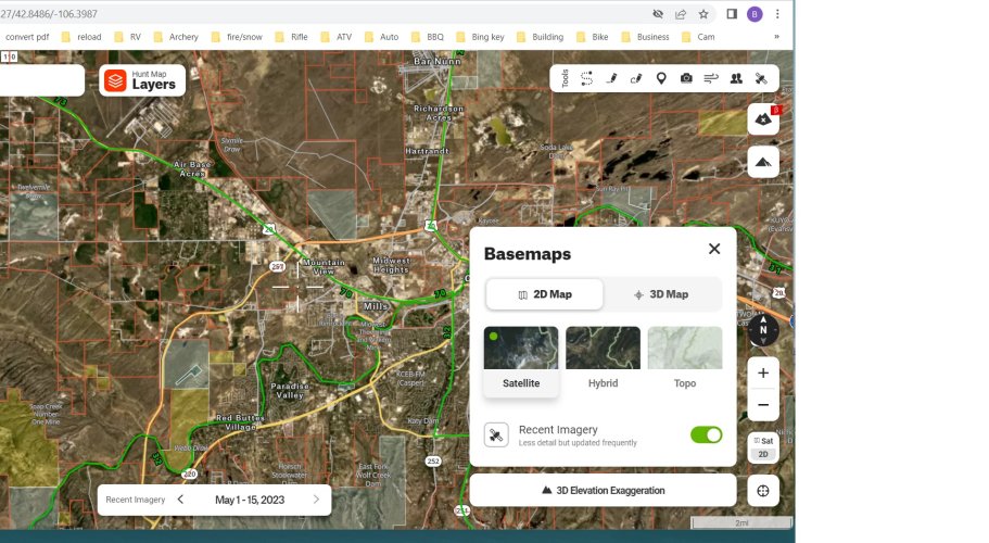
Is there a way that I can find out the date that the satellite image was taken?

Thanks
At the present moment, there is not.
 
In an effort to improve the accuracy of our road data, we have recently been switching over to a new data source. That data source has some roads labeled as private, which is why some of those roads are labeled as such on the onX map. Unfortunately, there are no true public/private road datasets out there like their are for public and private lands. We are able to use some state, federal, and county data sources to determine which roads are maintained and receive gas tax revenue, which means they are public roads. In cases where our data source labels a road as private, we tend to follow that label, unless we have strong evidence to the contrary. As you have noted, sometimes this does result in a misclassification. As for the notion that "influential landowners" are getting public roads labeled as private, that is not the case. We would never knowingly classify a public road as a private road, for any reason.

You can always report errors that you see using the error reporting feature in the App, or by emailing [email protected]
I understand the pre-caution, but the dataset that is now being relied upon appears to be quite inaccurate. The disappointing part is that the data used to be quite good and provide mostly accurate data in terms of access, yet blatant mistakes like these are detrimental to the trust in all data put forth by the application. I've attempted to use Mapbox's correction form and it is more frustrating finding these errors and having to go to the alternative data sources for confirmation. I know that the official data sources are to be verified for access, but seeing these more easily verifiable errors is troubling, MT HWY 360 for example appears in a simple Atlas. For the bit about influential landowners, South Bench Road access to the Little Snowy Mountains is peculiar with forest service access signs giving direction to it, and previously being on ONX. It was removed prior to changes in datasets and doesn't even appear as a "Private" road, thankfully the forest service has it marked from both directions.
 

Attachments

  • ONX-Private-Road.jpg
    ONX-Private-Road.jpg
    314.2 KB · Views: 11
  • MT-Road-Map.jpg
    MT-Road-Map.jpg
    288.4 KB · Views: 10
  • Little Snowies Access Road.jpg
    Little Snowies Access Road.jpg
    258.1 KB · Views: 11
  • Little Snowies Access 2.jpg
    Little Snowies Access 2.jpg
    72.1 KB · Views: 9
  • Little Snowy Mts. 527.jpg
    Little Snowy Mts. 527.jpg
    194.3 KB · Views: 10
Any updates on the android auto??????????
Right now, we are at least two months out from Android Auto being ready to go. It could potentially be later than late July-early August, depending on how all the development and approval goes, but it is not likely to be available before that timeframe. Our goal is to have it ready before most hunting seasons kick off this fall. Probably not the response you were hoping to hear, but I want to give you as realistic of a timeline as possible.
 
I understand the pre-caution, but the dataset that is now being relied upon appears to be quite inaccurate. The disappointing part is that the data used to be quite good and provide mostly accurate data in terms of access, yet blatant mistakes like these are detrimental to the trust in all data put forth by the application. I've attempted to use Mapbox's correction form and it is more frustrating finding these errors and having to go to the alternative data sources for confirmation. I know that the official data sources are to be verified for access, but seeing these more easily verifiable errors is troubling, MT HWY 360 for example appears in a simple Atlas. For the bit about influential landowners, South Bench Road access to the Little Snowy Mountains is peculiar with forest service access signs giving direction to it, and previously being on ONX. It was removed prior to changes in datasets and doesn't even appear as a "Private" road, thankfully the forest service has it marked from both directions.
Thank you for the further information and the context herre. That is very helpful. I've passed this along to our Mapping Team so that they can investigate further and see what they can do to better improve our roads data moving forward.
 
Thank you for the further information and the context herre. That is very helpful. I've passed this along to our Mapping Team so that they can investigate further and see what they can do to better improve our roads data moving forward.
The data from my first post did get resolved, so submissions to the Mapbox website appears to have a positive result.

Thank you.
 
I just chatted with a member of our Engineering Team. Basically, right now our Offroad team is working on building landscape mode and it will be available in that app first. The reason for this is that Offroad has, by far, the largest portion of users that utilize tablets. Tablet users are a pretty small number of of the overall Hunt App users, and landscape mode is not as critical of a features on the smaller phone app for most phone users. So it is not that we don't want to build landscape mode, but we try to prioritize the new features and improvements that impact the largest number of users. So that is a long way of saying that landscape mode is on our roadmap, but it is not going to be available in the near future. I'm sure that is not the answer you were hoping to hear, but I don't want to set unrealistic expectations that are not likely to be met.
So everyone who has the app and a tablet, please download it on your tablet as well if you haven’t already. Landscape mode would be soooo helpful when sitting on the couch “watching tv” with the wife.
 
Thank you for the further information and the context herre. That is very helpful. I've passed this along to our Mapping Team so that they can investigate further and see what they can do to better improve our roads data moving forward.
I would echo Shandon's concerns about road/trail data. I've hunted many areas in ND, MT, SD where the app showed a two track trail that wasn't there or showed a trail that was not open to public travel (non-motorized area or illegally established trail). Because it's shown on the map, people think it's GTG for public travel. In North Dakota, illegal motorized travel is a huge issue, not just in non-motorized areas, but on public land in general. I believe our local USFS office (Dakota Prairie Grasslands) has said they intended on discussing this issue with you folks to look for a solution, but I've never heard if they followed through with it. But it would help tremendously if there was confidence in OnX trail/road data being accurate. Has there been any discussion about changing symbology to show roads that are closed or not open for public travel and more effort towards QC to ensure the road data is accurate in terms of legal travel?
 
We would love to be able to confidently label all roads as public or private, but unfortunately, there is not currently a good, reliable data source that exists to show whether a given road is public or private. Oftentimes, government agencies are not able to tell for sure which roads are public or private as those records are often kept in file cabinets in field offices. We do not benefit in any way from having incorrect data and we strive to have the most accurate roads dataset possible, so we'll continue to explore every dataset that is available for us to use to provide the best data possible. We are also hopeful that the recent passage of the MAPLand Act will help us, and others, to have access to an accurate electronic dataset showing not only publicly accessible roads, but easements as well. The TRCP and Eastman's actually released a video earlier this spring that does a very good job of highlighting how complex this issue is and what is being done to provide better road data to mapping companies like onX, as well as the general public. It is worth the 35 minutes if you have some time to watch:
 
We would love to be able to confidently label all roads as public or private, but unfortunately, there is not currently a good, reliable data source that exists to show whether a given road is public or private. Oftentimes, government agencies are not able to tell for sure which roads are public or private as those records are often kept in file cabinets in field offices. We do not benefit in any way from having incorrect data and we strive to have the most accurate roads dataset possible, so we'll continue to explore every dataset that is available for us to use to provide the best data possible. We are also hopeful that the recent passage of the MAPLand Act will help us, and others, to have access to an accurate electronic dataset showing not only publicly accessible roads, but easements as well. The TRCP and Eastman's actually released a video earlier this spring that does a very good job of highlighting how complex this issue is and what is being done to provide better road data to mapping companies like onX, as well as the general public. It is worth the 35 minutes if you have some time to watch:
Aren't roads/trails and closures dictated by travel management plans and made available to the public via MVUMs? If there is an MVUM there has to be spatial data.

While I would acknowledge this would still be somewhat incomplete from district to district, having 75% of the accurate/official data would be better than taking a generic state roads layer that could've been digitized by an intern 30 years ago. Not to mention, once you folks start accumulating that data and putting it on the map, this will provide some motivation for districts without up to date data to get it updated for public use.

I would also hope, and maybe this is stretching it, that OnX would be involved in encouraging USFS/BLM to get travel management plans in place and create MVUMs, so you can consume the data and put that good information out to subscribers.

Just my .02
 
I encountered this Discrepancy where property lines and the state borders don't align. In the pictue below the state border is the property line....

What is the Recommended strategy when you encounter this situation?

1685985138704.png
 
Aren't roads/trails and closures dictated by travel management plans and made available to the public via MVUMs? If there is an MVUM there has to be spatial data.

While I would acknowledge this would still be somewhat incomplete from district to district, having 75% of the accurate/official data would be better than taking a generic state roads layer that could've been digitized by an intern 30 years ago. Not to mention, once you folks start accumulating that data and putting it on the map, this will provide some motivation for districts without up to date data to get it updated for public use.

I would also hope, and maybe this is stretching it, that OnX would be involved in encouraging USFS/BLM to get travel management plans in place and create MVUMs, so you can consume the data and put that good information out to subscribers.

Just my .02
Yes and no. The USFS, for example, typically has very good data, and we have an MVUM layer within the app that shows that data. The BLM, however, does not have a similar dataset currently. We are hopeful that the funding coming from the MAPLand Act will help to get all of that data digitized and made publicly available so that we, and others, can build out much more detailed and accurate road maps in the future. (You can read more about the MAPLand Act here: https://www.trcp.org/mapland/) We are already starting to see some of that data come out. The first batch that we have received, and is now available to onX users is the Forest Service easement data. We're not able to dictate which data get's digitized and made available first, we just have to take the new datasets as they come in. The process of digitizing the data is quite labor intensive, and as such, the MAPLand Act gives agencies until 2026 to have that data digitized and made available to the public, so we expect it to take a few more years before we have a complete dataset for these roads and trails.
 
I encountered this Discrepancy where property lines and the state borders don't align. In the pictue below the state border is the property line....

What is the Recommended strategy when you encounter this situation?

View attachment 278784
That discrepancy is most likely an issue with the county data that we received. To get this remedied, use the error reporting feature in the app to report this to our Mapping Team so they can investigate. For the steps to report an error, check out this article from our help center: https://onxmapssupport.zendesk.com/... the map feature that,button on the far right.
 
Hi @onX Hunt I noticed that when using Chrome and Edge, the panning on 3D is very laggy, Chrome seems to be unusable. What browser recommendations do you have for a smoother pan on 3D, or any browser settings I should tweak to make it better?
 
Hi @onX Hunt I noticed that when using Chrome and Edge, the panning on 3D is very laggy, Chrome seems to be unusable. What browser recommendations do you have for a smoother pan on 3D, or any browser settings I should tweak to make it better?
We definitely recommend using Chrome, and there are a couple of things to do to improve performance on your end. First, try clearing your cache and browser history. That can often improve performance. You can also make sure hardware acceleration is turned on. To do that, please follow the steps below.
  1. From the upper-right corner of your Chrome browser, click the three dots icon.
  2. Select Settings,
  3. Select System.
  4. Enable Use hardware acceleration when available.


    If you're still having issues after trying those steps, please email our Customer Support at [email protected]. They have access to some diagnostics that may better be able to diagnose the issue you're having on your computer.​
Still a bit laggy but a million times better. I’ll keep messing with it and write to you guys if it doesn’t work out. Thank you!
 
Gastro Gnome - Eat Better Wherever

Latest posts

Forum statistics

Threads
114,009
Messages
2,041,030
Members
36,429
Latest member
Dusky
Back
Top