Let’s hope this current snow system doesn’t just keep going or it may be august/SeptemberI have definitely been leaning towards some sort of mapping error from the beginning. The error is likely compounded in some way, there is no way its a 1k+ tall pillar. Just like if it was a big hole there would be pictures of it online and hiking trails to that spot already. Probably a rock formation no more than 150-200 ft above the surrounding rock.
I am still thinking I should hike in there next June and see if there are bears around. We'll see if ends up being a HTrs of North Idaho trip.
Navigation
Install the app
How to install the app on iOS
Follow along with the video below to see how to install our site as a web app on your home screen.
Note: This feature may not be available in some browsers.
More options
You are using an out of date browser. It may not display this or other websites correctly.
You should upgrade or use an alternative browser.
You should upgrade or use an alternative browser.
Topo Anomaly
- Thread starter westbranch
- Start date
D
Deleted member 28227
Guest
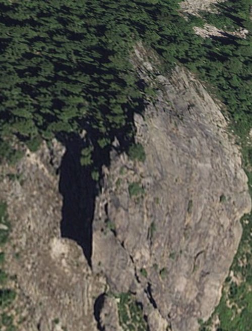
The topo looks like it’s 200ft, this photo shows a pretty intense shadow which would be consistent with a tower.I have definitely been leaning towards some sort of mapping error from the beginning. The error is likely compounded in some way, there is no way its a 1k+ tall pillar. Just like if it was a big hole there would be pictures of it online and hiking trails to that spot already. Probably a rock formation no more than 150-200 ft above the surrounding rock.
I am still thinking I should hike in there next June and see if there are bears around. We'll see if ends up being a HTrs of North Idaho trip.
Irrelevant
Well-known member
Do I need to provide a copy of my geology degree or my professional geology license?Look at the map. Basalt formations are common in the vicinity of the Clearwater River. If you need some assurance that basalt is a volcanic rock, I suggest you Google the term. And while you're at it Google lava tube. You'll see they are formed in basalt flows. Since the predominate rocks in the mountainous area of the Clearwater are either basalt or "granitic" (also volcanic in origin) it is unlikely this feature is a sinkhole. Those are found in limestone formations which are sedimentary/metamorphic.
You sir are an idiot.
I'd be very interested in doing just that. Talking about doing a fishing trip this summer in that area anyway.
XXL
Member
Thanks for the link, June may be a little optimistic for access, though it sits on a southerly facing ridge under 6K ft. This will be interesting. Thanks for posting.I have definitely been leaning towards some sort of mapping error from the beginning. The error is likely compounded in some way, there is no way its a 1k+ tall pillar. Just like if it was a big hole there would be pictures of it online and hiking trails to that spot already. Probably a rock formation no more than 150-200 ft above the surrounding rock.
I am still thinking I should hike in there next June and see if there are bears around. We'll see if ends up being a HTrs of North Idaho trip.
44hunter45
Well-known member
@JLS - You in Jason?I will slow you young bucks down, but I'm game to go up there.
RobG
Well-known member

44hunter45
Well-known member
No PBR. Enoteca in Post Falls is your friend.I’ll bring the beer, dog and juvenile gutter humor
Offering to buy me beer could get expensive. My Eberlestock could probably handle a pony keg.
Fingers crossed!
Gerald Martin
Well-known member
- Joined
- Jul 3, 2009
- Messages
- 9,416
White Spikes landing zone. Before you go check it out, mail me all your rifles and expensive optics for safe keeping in case you don’t come back.
Potsie
Well-known member
I’m in for a bear hunt. I’ll even be the idiot that brings in a watermelon.
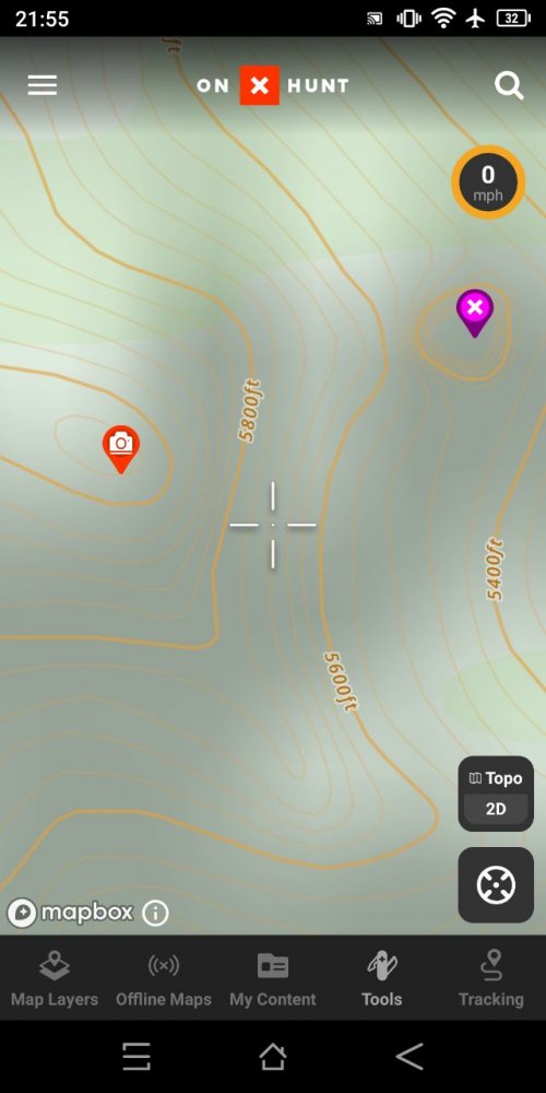
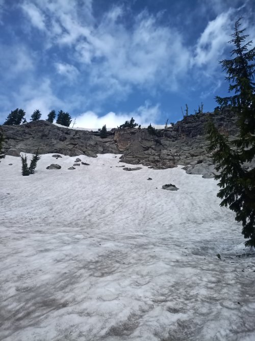
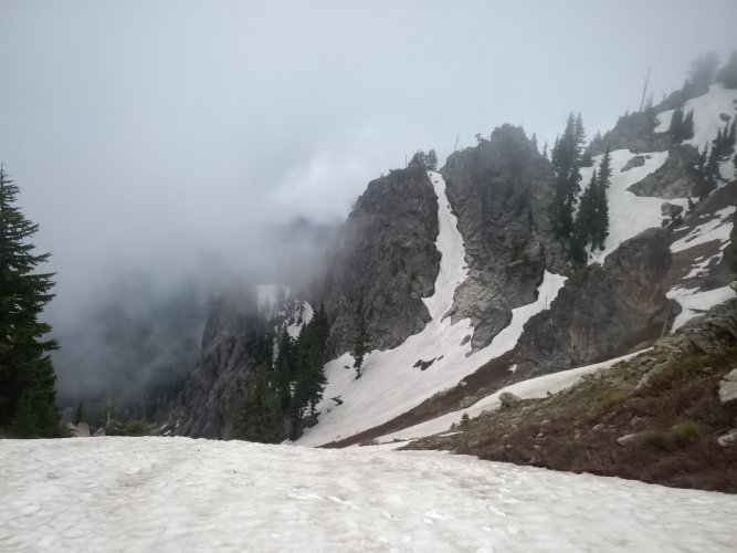
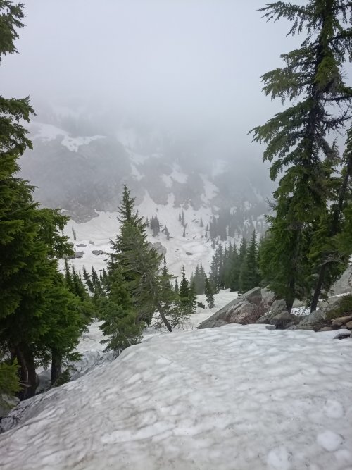
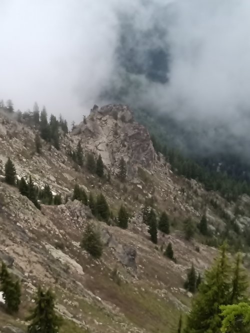
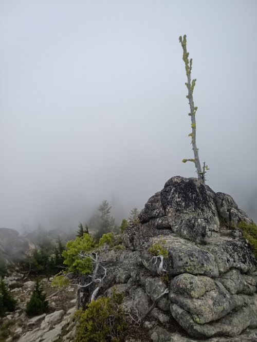
Well, I went and checked it out. Pretty country. Some serious snow up there still and unfortunately, when I got close, it was obscured by fog. As it was I was probably pushing it getting even to that point. It was real tricky going in some areas and I was alone, so didn't want to press my luck too much. I had good snowshoes but really needed crampons to do it right. I did get a pic from further away before the fog bank moved in of what I think might be the formation. If I'm right, it is indeed marked wrong on the map and is a spire, rather than a hole. The first three pics are just to show what the scenery looked like. The fourth is what I'm pretty sure is the spire, and the fifth is looking directly at it from 200 yards away (measured on OnX) from atop a cliff. The screenshot shows where I was when I took the pic.


OntarioHunter
Well-known member
- Joined
- Sep 11, 2020
- Messages
- 5,997
That final photo sure looks like pillow basalt to me.Well, I went and checked it out. Pretty country. Some serious snow up there still and unfortunately, when I got close, it was obscured by fog. As it was I was probably pushing it getting even to that point. It was real tricky going in some areas and I was alone, so didn't want to press my luck too much. I had good snowshoes but really needed crampons to do it right. I did get a pic from further away before the fog bank moved in of what I think might be the formation. If I'm right, it is indeed marked wrong on the map and is a spire, rather than a hole. The first three pics are just to show what the scenery looked like. The fourth is what I'm pretty sure is the spire, and the fifth is looking directly at it from 200 yards away (measured on OnX) from atop a cliff. The screenshot shows where I was when I took the pic.
View attachment 226891
View attachment 226887View attachment 226886
View attachment 226889View attachment 226888View attachment 226890
TN_Rifle_Junkie
Well-known member
Now that is a cool adventure... Thank you for closing the loop on this anomoly and taking the time to get some really great pictures of the area for everyone to see.
Nameless Range
Well-known member
Heck yeah. Thanks for this report.Well, I went and checked it out. Pretty country. Some serious snow up there still and unfortunately, when I got close, it was obscured by fog. As it was I was probably pushing it getting even to that point. It was real tricky going in some areas and I was alone, so didn't want to press my luck too much. I had good snowshoes but really needed crampons to do it right. I did get a pic from further away before the fog bank moved in of what I think might be the formation. If I'm right, it is indeed marked wrong on the map and is a spire, rather than a hole. The first three pics are just to show what the scenery looked like. The fourth is what I'm pretty sure is the spire, and the fifth is looking directly at it from 200 yards away (measured on OnX) from atop a cliff. The screenshot shows where I was when I took the pic.
View attachment 226891
View attachment 226887View attachment 226886
View attachment 226889View attachment 226888View attachment 226890
westbranch
Well-known member
Nice work! It does look like there is a good gap between that spire and the main ridge. Cool rock formation.
westbranch
Well-known member
Funnily enough, this past week I was looking at some trails in the Bitterroots of MT since we are going to be there for a wedding and found another anomaly.
Looks like this error is right on the wilderness boundary. It appears that somehow the GIS data for creek to the north was matched up with the wilderness boundary and followed it across the ridge to the south. So makes a very narrow canyon on the topo. But this error only shows up on Onx so not as exciting as the original post.
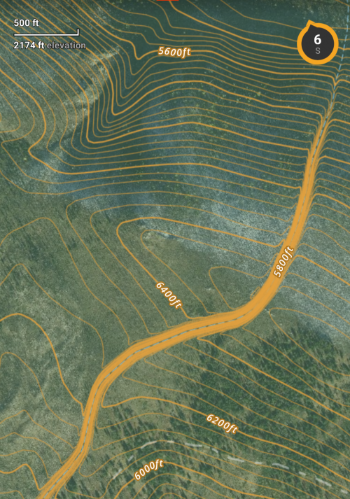
Looks like this error is right on the wilderness boundary. It appears that somehow the GIS data for creek to the north was matched up with the wilderness boundary and followed it across the ridge to the south. So makes a very narrow canyon on the topo. But this error only shows up on Onx so not as exciting as the original post.

Similar threads
- Replies
- 251
- Views
- 13K
- Replies
- 21
- Views
- 2K


