Reintroduced CO Wolves

ODFW kills wolves on a regular basis.
Yes, certainly a regular basis these days. A long list of limited duration kill orders and "removals" after successive depredation and nonlethal hazing. One reason why more packs may be killing more grazing stock, is due to the lack of other food sources.
 
Also correct me if I’m wrong but north park is not anywhere near the release site right? I doubt they would want those wolves anywhere near that Wyoming border
There were already confirmed pre-reintro wolves in North Park (3 of them already were legally killed in WY)

 
Those north park wolves, one with a tracker in particular, were already identified by cpw as atleast killing or injuring 13 cattle, 5 dogs, and 3 sheep. A rancher petitioned cpw to kill the one who was to blame for 7 cattle on his farm, Dec 22nd they denied it. The precedent is pretty set in colorado as far as ranching damage it seems. That's pretty egregious for a migrated in wolf that's only been here a short time.

But to be clear I can't find their reasoning for denying the request. So don't know much else of the background.
 
Ahh-shit-here-we-go-again GIFs - Get the best GIF on GIPHY
 
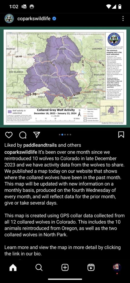
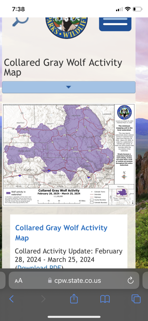
definitely a misleading map, which is done on purpose. but it does give a somewhat usable general idea of where they're wandering, sorta.
 
It’s a watershed map. Means they have been in that drainage

means they have stepped foot in that drainage. even if only as far as the minimum accuracy of the gps collar would show they stepped foot in one.

as they noted as an example - no wolves have been south of i70, but since they stepped foot in a drainage that goes south of i70, it's highlighted.

taken to the extreme, a map of the united states could highlight the entire state of colorado as having wolves in them, because there are 12 wolves in and around grand county.
 
It's honestly not that tough of a map to understand. Maybe a tad misleading but then again if we all had biologist mind and "super good map maker" minds then it wouldn't be misleading at all. Folks at cpw just shaking their head reading the comments on that post 🤣

it's not that it's tough to understand, it's just that it really doesn't tell you anything. the map leads you to believe there are wolves where they haven't even been yet and funny enough that was explicitly stated by CPW in their press release. so then if the map leads one to believe there are wolves where they actually have no documentation of them having been, it's misleading and doesn't actually tell me much.

my first thought when i saw that map is "oh shit, wolves are gonna start getting shot in wyoming like, tonight, or tomorrow"

then you realize the map leads you to believe they have gotten much closer to the border than they might actually have been as they likely just stepped foot in the southern portion of a watershed that reaches far north and therefore the whole watershed got highlighted.

we also don't know what watershed level they are highlighting. the HUCs can be pretty granular, or not so granular, depending on what level or "localness" of the watersheds they chose to map.
 
Last edited:
HUC10

 
HUC10


ah. see, if they did 12 it might be a somewhat meaningful map. but then that would actually tell us with more certainty where the wolves actually are, and then, oopsie

edit: i apologize for not looking closely everybody
 
Gastro Gnome - Eat Better Wherever

Latest posts

Forum statistics

Threads
113,653
Messages
2,028,574
Members
36,272
Latest member
ashleyhunts15
Back
Top