Grizzly Bear collar data

Irrelevant

Well-known member
Joined
Apr 17, 2015
Messages
11,333
Location
Wenatchee
Does anyone know if grizzly bear collar data is published online? Or if you can request it? I'd like to better understand the actual distribution on the landscape. I don't live in griz country, but am planning on hunting it. I'd like to review the location data to better understand how they use particular features of a particular landscape so that I can try to reduce the likelihood of encounters.
 
  • Like
Reactions: trb
I know Montana has a website that lists bear conflicts and relocations. I believe Wyoming does too. I don’t think collar data is published anywhere online, but I’m sure you could request it.
 
Having gotten collar data from FWP in the past, I would start asking now. It is a process. I don’t think it’s publicly available anywhere.

Also, outside of knowing the grizzly hotspots of the GYE and the Crown have denser bear populations than most, i’m not sure how useful grizzly collar data will be. They seem far more transient, and seem to set up shop in a location for a season or piece of time and move on.

There is a map out there of modeled potential habitat routes that’s pretty neat. Just on the road right now and can’t snag it
 
Last edited:
Does anyone know if grizzly bear collar data is published online? Or if you can request it? I'd like to better understand the actual distribution on the landscape. I don't live in griz country, but am planning on hunting it. I'd like to review the location data to better understand how they use particular features of a particular landscape so that I can try to reduce the likelihood of encounters.
It was and I'm assuming still on mtfwp. Usually was year old and certain drainages. It was super interesting to see travel patterns on Marias in places I fish.
 
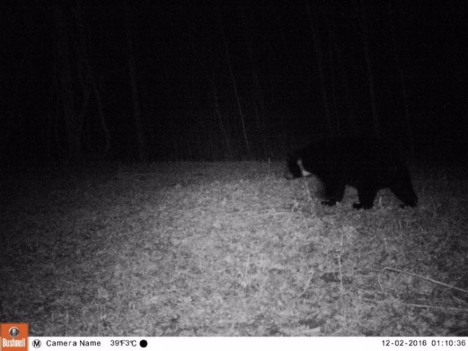
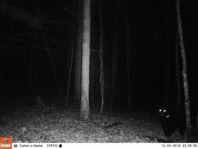
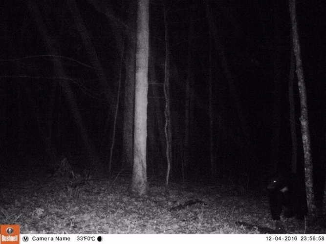
A little of topic but I had one of 6 black bears Virginia tagged on my property a number of years back. I called and talked to the bear Biologist and tried to find out where the bear was caught and where the bear was released and age and weight and they wouldn’t give me any of that info. They said it was for the safety of the bear.
 

Attachments

  • 287772F6-C813-4280-8532-1D9B05C98A7F.jpeg
    287772F6-C813-4280-8532-1D9B05C98A7F.jpeg
    83.4 KB · Views: 5
  • 47EB0D29-DC22-4BAA-999A-E41DB9DC4742.jpeg
    47EB0D29-DC22-4BAA-999A-E41DB9DC4742.jpeg
    80.5 KB · Views: 5
  • DF73E950-E509-43A2-B05C-C7A5979AC822.jpeg
    DF73E950-E509-43A2-B05C-C7A5979AC822.jpeg
    81.8 KB · Views: 5
Anecdotal, but you might find this interesting. A good friend of mine was a ranger in Yellowstone for a couple seasons, and got to sit down with a biologist to look at grizzly collar data in relation to backcountry campsite occupation. They had all of this data because obviously Yellowstone's sites are all electronically permitted.

When backcountry campsites were unoccupied, grizzlies wandered haphazardly through them, zig zagging through their own territories and beyond. On dates that the sites were occupied, grizzlies clearly avoided them, often giving them a significant berth.

Obviously this is second hand, but I thought it was interesting. Also, not sure you could extrapolate that behavior to outside the park, but areas like the Wind River range see similar levels of backcountry visitors and regularity of campsite use.
 
BTW, I was looking for WY. But really any of the three states would be cool to check out.
I checked I think I found it again under conservation. Format was different then I remember and bedded it within a number of report by zone
Still interesting
 
I inquired about wolf collar data from FWP and was advised it was not available to the public... Not sure about griz though may follow suit(?).

Wasn't worth my wolf interest at the time however, If USFWS obtain's collar data from States, you should be able to FOIA USFWS for the info.
 
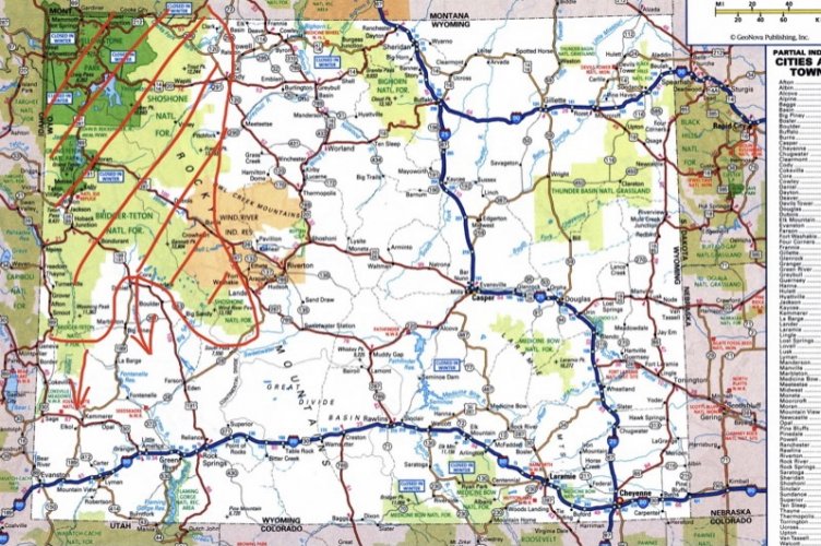
try this the another way. HT is a wealth of knowledge, so if users here would post the furthest south and furthest SE,
furthest E, and furthest NE landmark where they have PERSONNALLY seen grizzly, I’d bet you would have 90-95% of your WY map which will look something like this:

E4BD1E1F-8296-431A-B31A-CC6CF4AB4B67.jpeg

As far as landscape features, you’d probably expect stream corridors, riparian areas, blowdowns, rocky slopes, area with winterkilled animals…. in short food and cover! I shudder sometimes thinking of the places I naively crashed through in Yellowstone. But then seeing a bear that had taken down an elk calf right by the road and a hiking trail near Norris basin and then laid down and dissapeared into waist tall grass left an impression on me. But if even one grizzly is too many for you, potential would exist anywhere in their range, increasing along the central core ridges and rhe closer to the NW. Collar data may show you some cool information on how close to people, roads and backyards in towns they wander. I think MT has some really interesting data on bear movements well to the east of usual range and how good they are at avoiding detection. I know I’ve seen things published here and there, from one state or another. Wy may have same kind of data to the south and east. I’d love to see it plotted too, but doubt there is comprehensive data, more just individual bears.

Yosemite has a black bear tracker: https://keepbearswild.org/bear-tracker/

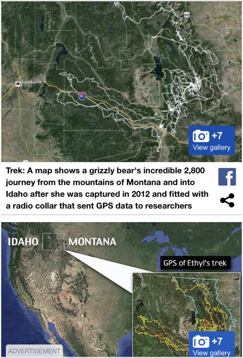
Here’s an interesting MT/ID track:

CB6ADD32-22AC-48D2-BBC5-0F2CFE68D09E.jpeg

Eastern Mt prairie bear: https://www.greatfallstribune.com/s...izzly-bear-sighting-living-memory/5334309002/

Southern WY bear: https://oilcity.news/community/anim...range-furthest-south-since-well-before-1970s/
 
Last edited:
My inquiry stems from listening to an Elk Talk podcast with Mr @Big Fin and Corey J were they discussed hunting in grizz country (ep 55). In it, Randy references seeing GPS collar data that indicated a particular drainage had a disproportionate number of grizz and he wasn't interested in killing an elk in there. I would think public safety would trump bear safety (though they're sorta the same thing in a lot of ways) and location data would be available even it only by FOIA request.
 
First, I think getting actual locational data for individuals of a T&E species via FOIA is a long shot as it is usually considered sensitive information. Second, I’m not sure knowing a few specific individual’s locations would necessarily be particularly useful for your stated purpose. It would depend a lot on the sample and how the data were collected. Raw collar data isn’t just used that way. There’s a lot of analysis that goes on behind the scenes before drawing conclusions about densities and distributions.

You would probably do better to see if the state has density or occupancy maps or something- more of a product rather than raw data.
This won't be my first go 'round with raw data analysis.

"Products" seem to be deliberately not being created. The current policy is that bear location information is a detriment to both human and bear welfare. Looky Lous and all that.

I'd be pretty disappointed if it wasn't available at all, in any way shape or form. If I can get deer, elk, black bear, cougar, and friggin' spotted owl nest locations, I damn sure ought to be able to see grizzly bears.
 
First, I think getting actual locational data for individuals of a T&E species via FOIA is a long shot as it is usually considered sensitive information. Second, I’m not sure knowing a few specific individual’s locations would necessarily be particularly useful for your stated purpose. It would depend a lot on the sample and how the data were collected. Raw collar data isn’t just used that way. There’s a lot of analysis that goes on behind the scenes before drawing conclusions about densities and distributions.

You would probably do better to see if the state has density or occupancy maps or something- more of a product rather than raw data.
But yes a heat map, even at the section level, would be nice to see. It would also be nice if data products were maintained and updated over time, instead of a snap shot in 2007 and nothing since.
 
I found the capture/release location maps from WFGD useful as far as seeing where problem bears are each year, and where they're moved to, definitely some patterns year to year with conflict areas, and there's a few areas where they tend to release them. At least gives you some red flag type areas. The JCRs are also interesting, I'd start by contacting one of the authors and see what they tell you.

 
I found the capture/release location maps from WFGD useful as far as seeing where problem bears are each year, and where they're moved to, definitely some patterns year to year with conflict areas, and there's a few areas where they tend to release them. At least gives you some red flag type areas. The JCRs are also interesting, I'd start by contacting one of the authors and see what they tell you.

I fear contacting them and "discussing" something is going to be the only available data.
 
I fear contacting them and "discussing" something is going to be the only available data.
That's probably fairly likely, but who knows since you're not planning to use it for hunting or commercial purposes. It can be an ordeal just to get sensitive species data sharing agreements between state and federal agencies.
 
That's probably fairly likely, but who knows since you're not planning to use it for hunting or commercial purposes. It can be an ordeal just to get sensitive species data sharing agreements between state and federal agencies.
Every time I've done it in the past, I've simply requested it, and signed a disclosure that I won't share or disseminate it.
 
Not sure how helpful it would be, but ADFG has tracks a few bears around Anchorage and has maps on their website, or used to that showed movements. It was pretty interesting. Sows tended ro stay in one area and boars would roam. They may provide some data for animals that are dead, but don't usually provide data for live animals. I've looked over the shoulder at some live data for other animals.
 

Latest posts

Forum statistics

Threads
113,575
Messages
2,025,514
Members
36,237
Latest member
SCOOTER848
Back
Top