I'm sure other guys do this, but its not real straight forward, so I thought I would share how I use Google Earth on my Iphone and Ipad with unit boundaries overlayed. It isn't as functional as the desktop version of Google Earth but the convenience is nice
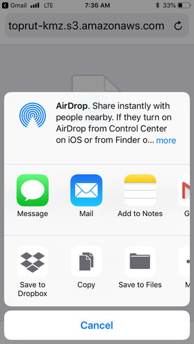
Step 1: Download the .kmz file for the unit you are looking at. They're available multiple places online. I got this one from toprut.
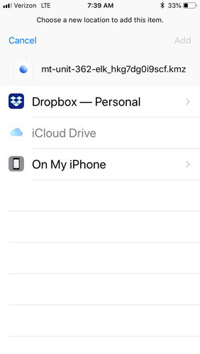
Step 2: Save to Files on your Iphone. I select my Dropbox folder. You may need to have Dropbox installed on your phone. I haven't tried it any other way.
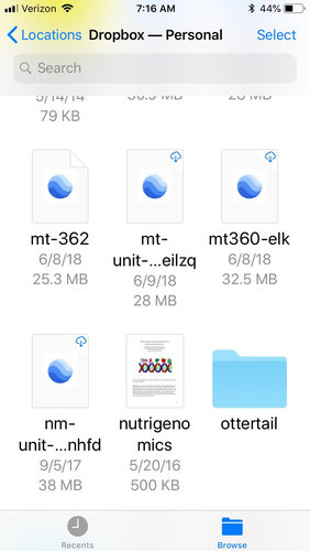
Step 3: Select the file you saved within the Files application to download it to your device
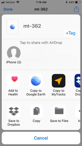
Step 4: Tap the upload button in the top right corner of your screen and scroll to "Copy to Google Earth"
Google Earth will open showing your unit boundary.
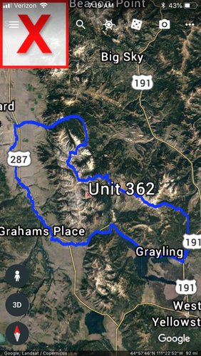
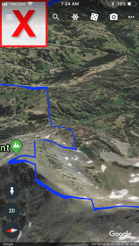
Use the 3D button on the bottom left to get a good 3D view and Scroll around.
Let me know if you have any questions. I know its about as clear as mud.
Step 1: Download the .kmz file for the unit you are looking at. They're available multiple places online. I got this one from toprut.
Step 2: Save to Files on your Iphone. I select my Dropbox folder. You may need to have Dropbox installed on your phone. I haven't tried it any other way.


Step 3: Select the file you saved within the Files application to download it to your device
Step 4: Tap the upload button in the top right corner of your screen and scroll to "Copy to Google Earth"


Google Earth will open showing your unit boundary.


Use the 3D button on the bottom left to get a good 3D view and Scroll around.
Let me know if you have any questions. I know its about as clear as mud.


