GAIA App

plumber1969

Member
Joined
Aug 1, 2016
Messages
224
Just wanted to know if anyone here uses this app over a traditional GPS? I have used it on my hikes through our local woods and it is pretty accurate and since we will be truck camping the battery drain shouldn't be an issue but I did buy 2 of those usb rechargables.
 
The app is excellent for its intended purpose. The native vector maps take up no memory and have many trails not found on other maps. The satellite views are meh. If I could only have one, no doubt ONX. But I use both.

Very useful for tracks.
 
I will be checking out Gaia GPS... it looks promising. I was using a Trimble Outdoors app that was awesome -- great GPS functionality, syncing and downloading data to/from website, sharing trips, etc., but Trimble recently discontinued it. I subscribed to OnXMaps, knowing it would be useful for landowner data and also expecting it to be a replacement for the Trimble app, but I really don't see how the OnXMaps app can be used to replace a GPS. At least, not the way I'd like to use a GPS/GPS app.

While the OnXMaps data is invaluable, it really lacks a lot of very basic GPS functions:
Can't pick a waypoint and "Go to" waypoint -- you have to somehow find it on the map and then just mentally keep track of it (not easy if you have a lot of waypoints on the screen) and try to keep walking towards it by trial and error -- there is no compass view.
No tool for measuring point-to-point other than the map scale.
No organizing waypoints.
No viewing route data such as elevation change, distance traveled, avg speed, etc.

If you just want to look at your current location on a map, nothing more, then OnX alone may work for you. I hope they have some improvements for the app (and web version, for that matter) planned, because I'd really like to be able to stop going back and forth between OnXMaps, Google Earth, Gaia, Avenza, etc. I see a lot of potential, but just disappointed with the current level of functionality.
 
No tool for measuring point-to-point other than the map scale.

No viewing route data such as elevation change, distance traveled, avg speed, etc.

While I agree it doesn't do EVERYTHING that a standalone GPS does, it does some of the things you mentioned.

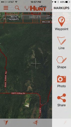
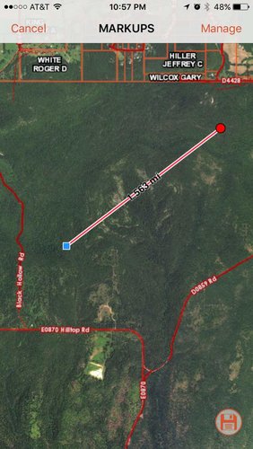
Your can measure distances using markups, line....

IMG_1661.jpg
IMG_1662.jpg

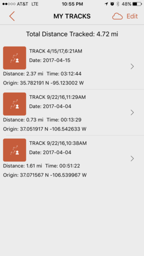
You can view distance travelled if you turn on tracking....

IMG_1660.PNG
 
I use them all. I'm a bit of a geospatial junky. I do like the Gaia app due to the functionality of it and the intuitive user interface. If it had the property boundaries it would be perfect.
 
Kenetrek Boots

Latest posts

Forum statistics

Threads
114,245
Messages
2,049,406
Members
36,525
Latest member
TimelessTim
Back
Top