Navigation
Install the app
How to install the app on iOS
Follow along with the video below to see how to install our site as a web app on your home screen.
Note: This feature may not be available in some browsers.
More options
You are using an out of date browser. It may not display this or other websites correctly.
You should upgrade or use an alternative browser.
You should upgrade or use an alternative browser.
Erik, any info on the caribou up north?
- Thread starter Leob
- Start date
AkBearHunter
Member
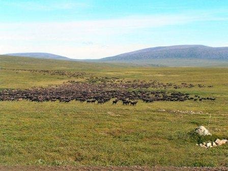
Don't drive off the road, BLM will give you a ticket and you'll have to appear in court, been there and done that!! I've been hearing reports that there's a big herd of caribou between Galbreath Lake and Pump station 3. Sounds like it's starting to heat up.
Ooops! I guess I wasn't very clear with my first message. I didn't actually mean that I wanted to drive offroad, but rather drive off the Haul Road on another road. There is a road going off the Haul Road near Galbraith Lake. One can drive back this road for a mile or two, thereby shortening the five mile distance one has to hike away from the Haul Road.
Erik in AK
New member
I just arrived back at work today and I'm on nights so I won't have any first hand knowledge but I will get reports from my partner and post them here.
Yes you can get off the haul road. The road leading to the Galbraith airport. From the back of the gravel pit on the west side of the airport cuts your walk to just under 3 miles.
Also at Kuparuk River: at the top of the hill on the north side of the bridge is an access road to an Alyeska gravel pit and a UAF research site. While you can't drive in it does at least allow you to get about 2 miles in on hard ground. Last year I saw two guys on mtn bikes towing what looked like home built cargo wagons.
Alot of people inquire about canoes and boats. Small boats can be used to cross the Sag when the animals seem to hang up on the far side. You can get outside the corridor in a canoe from Toolik Lake as well. Simply canoing to the west shore puts you about 2 miles, or go to the northeast corner of the lake (look for the storage connex) and follow the outlet stream through 3 or 4 little connector lakes. This stream lake takes you directly away from the road. You would have to paddle or line the canoe back upstream and under load until the last pond but you would save the effort on the walk in. If you choose this option mark a waypoit with your GPS right where the road begins the "Big Bend" just past the Toolik turn off. As you proceed downstream you should hit the 5 mile mark about a mile and a half past the last pond. By all means check your maps.
If you walk in while you're up here remeber that generally the streambeds offer firmer walking.
Good luck.


