


I am doing the e-scouting for our group with two bull and two cow tags in Region W of Wyoming. Our side focus is grouse and black bear. Our rifle hunt is in the first half of October 2024. The rut will be over but some bulls will still think it's on. We have four llamas.
I will try to give as much detail on each area without providing the Area number where so I can hopefully refine our hunt approach.
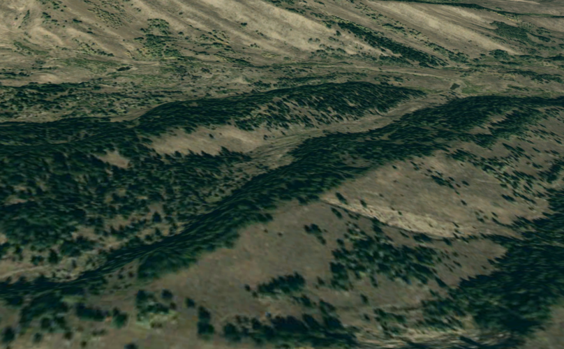
Trailhead A. (30 min drive from C; 1 hour from B). The TH Begins on a ridge at 8200' along the border of a 1-year old burn that is already producing fireweed. The ridge runs north and south with basins running east and west. 1.5 miles from the TH is a basin that appears to hold water with 2-3 springs. The north slopes have moderately thick pines, aspen growth in the basin, and bare south slopes. The terrain does not appear too steep and the bottom of this and the other basins along this ridge are roughly 7,000 feet.
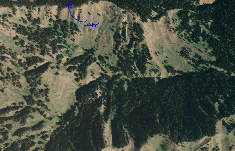
Trailhead B. (1.0 hour drive from A or C), Parking spot at the no-named TH begins at the bottom of a basin at 7,800'. 2.0 miles from the TH is a pretty good campsite at 9,500'. I say a trailhead, but there is no 'labeled trail' on any maps that I can find. The pass above this basin is 10,000'. Our campsite is below a ridge that runs east-northeast and south-southwest between two basins. The north basin has a stream with no name and the south basin has a named stream; neither of these have any trails with names on them.
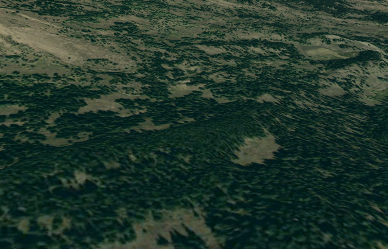
Glass Spot 1: 3/4 mile east from CampB: The two (2) E-W basins are characteristically steep for this region and have heavy timber on the north slopes with several open meadows and appear to have one or two avalanche chutes. These north-slope meadows face the northeast and seem to be pretty green in all of the historical imagery I could access. The south-facing slopes seem to have some gnarly chutes that provide enough shade for several stands of evergreen timber. Our glassing spot is 3/4 miles from camp.
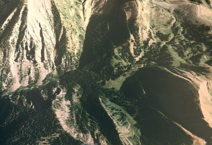
Glass Spot 2: 1 mile west from CampB: On the west side of the pass above this basin, the main valley below is 5 miles across and contains a majority of gentle sloping terrain with little tree cover; this valley starts on the east at 10K feet, drops to 8,200' in the middle and rises back up to 10,200'. Despite the gentle terrain, it has several relatively small steep cuts that run east and west with dense pockets of trees on their north slopes. These cuts are about 3-400' deep.
A couple of named trails run through this area on the west and east sides of this large basin; one near the bottom on the east side and the other parallel trail runs on the upper west slope, but not the ridge. Onx's peak roadless area displays a purple-white haze on the western side of this valley.
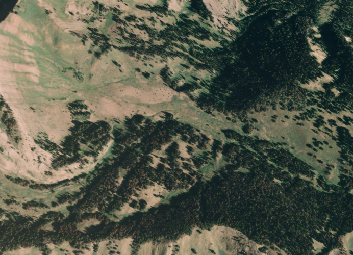
Zooming in on satellite imagery, I can see a lot of game trails running in and out of the purple haze area. I do not see near as much game traffic outside of these areas, so there is some observable contrast in potential activity.
Trailhead C. (1.0 Hour Drive from B, 30 min from A). 7-mile hike beginning at 6,900' up to 9,900' with camp at 9,700'. The basin starts on the east and runs to the west. Very steep and remote for this unit. Outfitters are often in this area.
**************
A local told me about the fire in TH A and it is not on Gohunt or Onx. A biologist I spoke to is not aware of this burn, but agrees and encourages me to focus on TH B. He thinks hiking to TH C will skip a lot of good elk country just to get to good elk country with more outfitters.
I'm trying to sort out 1) which area to hit first and ask for any 2) pointers to improve preparation.
I will try to give as much detail on each area without providing the Area number where so I can hopefully refine our hunt approach.
Trailhead A. (30 min drive from C; 1 hour from B). The TH Begins on a ridge at 8200' along the border of a 1-year old burn that is already producing fireweed. The ridge runs north and south with basins running east and west. 1.5 miles from the TH is a basin that appears to hold water with 2-3 springs. The north slopes have moderately thick pines, aspen growth in the basin, and bare south slopes. The terrain does not appear too steep and the bottom of this and the other basins along this ridge are roughly 7,000 feet.
Trailhead B. (1.0 hour drive from A or C), Parking spot at the no-named TH begins at the bottom of a basin at 7,800'. 2.0 miles from the TH is a pretty good campsite at 9,500'. I say a trailhead, but there is no 'labeled trail' on any maps that I can find. The pass above this basin is 10,000'. Our campsite is below a ridge that runs east-northeast and south-southwest between two basins. The north basin has a stream with no name and the south basin has a named stream; neither of these have any trails with names on them.
Glass Spot 1: 3/4 mile east from CampB: The two (2) E-W basins are characteristically steep for this region and have heavy timber on the north slopes with several open meadows and appear to have one or two avalanche chutes. These north-slope meadows face the northeast and seem to be pretty green in all of the historical imagery I could access. The south-facing slopes seem to have some gnarly chutes that provide enough shade for several stands of evergreen timber. Our glassing spot is 3/4 miles from camp.
Glass Spot 2: 1 mile west from CampB: On the west side of the pass above this basin, the main valley below is 5 miles across and contains a majority of gentle sloping terrain with little tree cover; this valley starts on the east at 10K feet, drops to 8,200' in the middle and rises back up to 10,200'. Despite the gentle terrain, it has several relatively small steep cuts that run east and west with dense pockets of trees on their north slopes. These cuts are about 3-400' deep.
A couple of named trails run through this area on the west and east sides of this large basin; one near the bottom on the east side and the other parallel trail runs on the upper west slope, but not the ridge. Onx's peak roadless area displays a purple-white haze on the western side of this valley.
Zooming in on satellite imagery, I can see a lot of game trails running in and out of the purple haze area. I do not see near as much game traffic outside of these areas, so there is some observable contrast in potential activity.
Trailhead C. (1.0 Hour Drive from B, 30 min from A). 7-mile hike beginning at 6,900' up to 9,900' with camp at 9,700'. The basin starts on the east and runs to the west. Very steep and remote for this unit. Outfitters are often in this area.
**************
A local told me about the fire in TH A and it is not on Gohunt or Onx. A biologist I spoke to is not aware of this burn, but agrees and encourages me to focus on TH B. He thinks hiking to TH C will skip a lot of good elk country just to get to good elk country with more outfitters.
I'm trying to sort out 1) which area to hit first and ask for any 2) pointers to improve preparation.

 .
.