MTNTOUGH - Use promo code RANDY for 30 days free

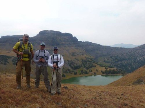
Bridge Lake, Absaroka-Beartooth Wilderness.

npaden

Well-known member
Joined
Feb 3, 2011
Messages
4,904
Location
Lubbock, Texas
Anyone ever hiked to Bridge Lake from the Mill Creek side?

Thinking about doing it the first week of August as a day hike. Looks like it would be a good workout anyway. Looking at it in person last time I was there it looked like you could go around to the North side of the lake and make it in and out. I'm thinking this would be a good hike to check out what kind of hunting shape I'm in.

Just curious if any have tried it?

Thanks, Nathan
 
Killed goats on both sides, but didn't go over the top. I am sure it is possible, but it never crossed my mind either time. I would be interested on hearing how it goes.
 
Crow mountain is big in person but it's probably doable. Bridge cr would definitely be easier.
There were 6 griz to/from elk lake a few miles away last summer.
 
I've been to both sides, but never crossed over. I've heard it's possible, and I've seen the spot where I would cross over, but don't know 100%. I can say that there is likely only one way. It'll be steep, but not ridiculous...that being said, I think it's something I'd rather try with a buddy than on my own. Definitely carry bear spray, and a camera for the goats! If you have an hour to spare, there are some good sized fish that like a bead head on the end of a fly rod! If you do it...let us know!


IMG_2173.jpgIMG_2174.jpgIMG_2175.jpg
 
Last edited:
Thanks for the replies! I figured there might be some folks on here who have at least been in the vicinity a few times.

Kind of silly to try it from the Mill Creek side, but we go to a bible camp up there each summer in the Mill Creek drainage and it would 50+ miles of driving each way to go around to the Boulder River side and come up from that direction vs. just about a 5 mile drive farther up Mill Creek Road and then a tougher hike from there.

I've been going to this church camp since I was a kid so I've hiked to about every feature a half dozen times or more and I've been branching out a little the last couple years. Last year we hiked up to the Cirque Lake above Elbow Lake and intended to traverse over to Fire Lake from there but it looked a lot sketchier in person than it did on Google Earth so we chickened out and just came back the way we went up.

I would be doing this with a buddy, I'm not sure he is in shape to get it done but I guess we will find out. It really doesn't look that tough, the elevation gain isn't terrible, but without a trail that always adds some effort to things, and this is going to have quite a bit that is going to be more of a scramble than a hike but I think it should be doable. Using Google Earth and drawing a line it shows about 6.5 miles each way, more than likely it will be a bit more than that by the time we actually knock it out.

This is the route that I think we will try.

R-qs6DWb50p-CKKxqYPgEBb2V5p1MGwwGjXFQf-aEwpNUZ9hIw8_hAfdJYfLvrxErFNOP9_YJD80l7SudiqY-p1TrA6PAY1yUCRlUDA-w8EsoKPvlbEN8NeevL5DXzEF8gq3jiTqxCV7InW9GTAhWMxQdGApluNLvBUZcUa9ugpjbYnXFpkUx3k8-lqcHDHbURJyvRDsxN5ipdboxj8SM3bd9CV1z3OitPWZtgYP5fg7txncwmI9VLZtdjWwzniresZQkqav66cPgb0cbWIYcAn0vimpjHGwVMS5r1RJe4rYuzzy_gGph0LGO9wEUuRNT_HAzn3E9Mz7bBodusB5tOpw6r3mouF91Rs33iTl6OEwVQQMeTFH7JpcUgSDRpvCfoPIOQnfoLcdz_wGYEVb9RULrj0vus402QzZOOkyTDKG9ZmNdP-mdQkvYkjGU5wWkis2VXY44dXgjN-yQDkvU1Zwo2ROMabPzRr2QOfXQ26e2b0zWbGPIDYNeadiMCWponCpRGJ2c2Wn3n2_ZqLVXv3L0IiRf0DILzYWl4WD6kQd8AnZjDD7cRMGtiqAxOGv5U0hsrzPZIwy1YtM8aPc0VPFnb2gfnBaerspWZsSyQN50fyDIpMDAOU=w1571-h933-no


TL-kMuEYXjmQdzgr8P_lrMffLypOoU8NFnGI8WfAMK8WEp9kyi_nRzHPdXJPWOm29jHlLcOAefduagkL0FypyOfAq9xFhIsftAk-AWSjH2JMewW9dyaV8n4U8Hi5MrNm9fGA-2S35kVU-41I-2jvYviXRZ-w-Mx1dce8remV25VwDJtWiCvI2_ar0AhGWpkWR2vadGsfrU-F_KgCJgHYonLkjEKmspPjvQ6gObkJROWDuc06l_wn7_08KVAJB5CcfCxpFyghKVXCp9eo3GA2cQk6hZoYfGczWawUFPnSIsc9_Agpv5UV1C3qTRBV27Bxsc9J4D1NtQghQ5hjrAzyajNsbaxK__X4g6MMjyuT1FtPo9ljdwKG_Kp_3k10tsM6S4lPa-yRpPCp4s0SfO45GN0qneE0rroFiwWuGqPmUoMiXqpFQGyYwMshQ8VfXyxqaaBRdRrmhmo97lx73dAmayWOUx7So7fvcEtmm1vwS8_hNWovwvQhSH2TZ2JtQ6rMtTGao3wyCGjUfbPjly5eW5uCo7OFhHdRgXaBoCFi9GM9w2fp64WKHUI2l3QxU7q0Yvq8VznLuQPMZsmgT-_SDITrCo5_2WyXVLXOpm7esGJCOAJdL33MXrM=w1571-h817-no


Thanks for the tips on the bears, I generally carry bear spray in that area but I will be more attentive knowing there are probably some in the area.

I think this is worth a shot. Would be fun to see a bunch of goats. I will update with whatever we decide to do.

Thanks, Nathan
 
Last edited:
Google Earth is really an amazing resource. At the same time it does have limitations. It is amazing I can pretty much find the exact spot that picture was taken.

attachment.php


kdlsttcZGEpVtVCWM67MUcCRrBvPuDcaVmyVAjVJ_WaQVN0BuWSRpVjmamQx2OVeO6KROxqq9wzbnqqQnDRf7I0WLLPo6qAqGBmf_pbmp5xweZnncMWhPOH5ZLMOBS0l9s38kZIeA0qw_oVXENueIWdG4weVE56-Dtcj4boGuYMtTFTWn7JxzcfzuWcRayTz8j9urUt5p9pbP2q4JqeKYC04aNsWhr5QOXKt0tYWZlUAJH6XAJmJlj2yBqcdsfhCaZ0AAX7hL83bEgEwVRXW9dG2nVa3I0HhdjRLUoOFzyYSIvYCEhnMRAyGL_88PS-BqzHFE25A9q-ZTrxomttVnfoQdpXxCiWY_lN8-69X0w-qsDgPN_uLoZ2NFpc81_tkxnIAABHXkKxjs0F05mk0Q3mE2IwjjlQj4zFlnk9OZ0LD5atevCwOo-HwB2gmvyml0AnKtHp9JsyLENKsPR-1yDciF0ylYxqq4TfQ7HAMKhw8NqVYMOQrCisKH7Ov0q0fKHEj-afwqhkRIiJmfaqujDPstcXGl_RbUXAL03VlKVg5u4qDbNRb-yt4m89QecNAuAMThb0jtCTTpLbk13Glf1kM2lw5vFDF5KMhIEEsVbUeTRmzZh_XUbo=w1204-h691-no


One limitation is that it almost always makes things look too easy. The area I circled in yellow almost looks doable if you are just looking in Google Earth. Then look at the actual picture. Pretty much nothing but a bunch of small cliffs. Not really something I want to be hiking if I can help it.

The red line is the route I would be planning on coming in to the lake from. Just can't come up with a better option.

Thanks again for the comments and the pictures.
 
kdlsttcZGEpVtVCWM67MUcCRrBvPuDcaVmyVAjVJ_WaQVN0BuWSRpVjmamQx2OVeO6KROxqq9wzbnqqQnDRf7I0WLLPo6qAqGBmf_pbmp5xweZnncMWhPOH5ZLMOBS0l9s38kZIeA0qw_oVXENueIWdG4weVE56-Dtcj4boGuYMtTFTWn7JxzcfzuWcRayTz8j9urUt5p9pbP2q4JqeKYC04aNsWhr5QOXKt0tYWZlUAJH6XAJmJlj2yBqcdsfhCaZ0AAX7hL83bEgEwVRXW9dG2nVa3I0HhdjRLUoOFzyYSIvYCEhnMRAyGL_88PS-BqzHFE25A9q-ZTrxomttVnfoQdpXxCiWY_lN8-69X0w-qsDgPN_uLoZ2NFpc81_tkxnIAABHXkKxjs0F05mk0Q3mE2IwjjlQj4zFlnk9OZ0LD5atevCwOo-HwB2gmvyml0AnKtHp9JsyLENKsPR-1yDciF0ylYxqq4TfQ7HAMKhw8NqVYMOQrCisKH7Ov0q0fKHEj-afwqhkRIiJmfaqujDPstcXGl_RbUXAL03VlKVg5u4qDbNRb-yt4m89QecNAuAMThb0jtCTTpLbk13Glf1kM2lw5vFDF5KMhIEEsVbUeTRmzZh_XUbo=w1204-h691-no


The red line is the route I would be planning on coming in to the lake from. Just can't come up with a better option.

In 2000 I went to the saddle you have on the map. I did not go all the way to the lake, just started straight up. I remember it being a bitch, but obviously doable. I have some pics I was going to share, but photobucket apparently isn't letting me use it as a host any more unless I want to pay. I don't. I was lucky enough to find a good billy up there.
 
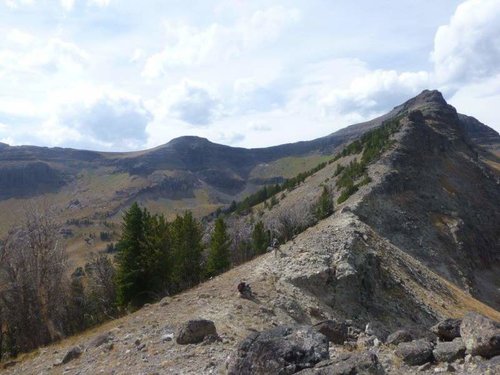
Last year we camped at the lake and then dropped down and climbed up to the saddle you're showing. definitely a bitch. where you show your path coming down off the saddle, you need to get below that little cliff band before you cut across or you'll cliff out. also, you'll be dropping all the way back to the valley floor before climbing back up to the lake. the hardest part is still going to be getting around crow mtn...while I'm sure it's possible, I think it's going to make the rest look easy. This pic is from the saddle in your pic looking back towards bridge.

P1020099.jpg

It might be too much for a day trip, but you can always turn back...
 
I hiked up to Crow on Bridge Creek about 10 years ago. Came out of Christikon. One of the best experiences of my life. This Friday, my dad and I are headed to either the Bridge Creek trail or Lake Fork Trail out of Red Lodge.
 
I did it half a dozen times a couple years ago. I thought it was pretty easy. PM me if you want some specifics.
 
Well it ended up being a pretty nice hike. The trail from the Lambert Creek Trailhead goes almost 5 miles up the basin to the base of Crow Peak and there are for sure a couple different options from there.

n8cx4hZKVTN5oBePwZEg2OxEAeSqPyt1UgUN9o_u5M7-_ESd_Fd5Ga8JrIvAsW6Pv2Ft44Y2YZ7B1b0Kp2nlbmvLxMMiyFYLs4ACVZDk62wumGUoTlO2nhXAekslzQqWrV3iY_neAxZwYqBUwK1BIPhv6a-2HKTgDrCcqp7VftzGr5FtkZ1WUczlOKn3z7aaAqtOIcaYA3nQTJ_YOXS5LPO8E22HbYuYMkc0ZjBQwkBcTM9c-p8TOgDV15d-pKrT_4D59k15BBMbOSGyEoLeB-kiOu_DTHH4IVyo8ySzsuk7AuIgvT7tWO8fLNn5HVqRRm7k5JqNvgjQz0ZQ-HUFa78cT4b1P7J2G0gy30JhSNORBEqQU3n9eX3moq4j-DQtJRbtLEPDRXTVj-5-to_Mv4IDB_MsLTLUh9T700CSkPk35Dnz_XR85Hrf5dYXl7IVu9zSRWCL73ol0wqieHCP6biVCIA4R5ADyl36IYiPkvDlRh-s7wTKaYaOM9ehqSA_fv63_ExjinZlWDgo-OlRaMa5zY89o9eveZDePsocYirJfxmVoTIgFXGmgti4ZzwSLFizXQuUi6C-8l_RKkH--W3v7q2wLrg5L4Yapxy6c_9uW_2n6JZN9k0S=w1267-h950-no


From the trailhead to the lake was around 6.5 miles. We logged closer to 14 miles total round trip but that included the detour up to the top of Crow Mountain since we were nearly there anyway.

6bmgqEz7K2OfnHscVfS9rXzP09CDsa2ba_Tdat7rsJOeMSjmxo4SD1x3XXEzDN2WtqPVawhrHpu8NYy4NIZS4IRM9Kp7aAq7sb6uuSRDviDIltgPTRaDj9iWIsyAkSVR_5I4uSmzxgEvRpwIhn_4qk3X5w3kggbRuDI37gXOWWM36pOHlIeN4HG8CLp8zY8YfJmM7EJ5jrZNqWYWQ-AhQQmVfPGmfqn1FGoBoCBmdUoB0u3Kwih69VhRwsaGGF9kEqKwCXXgZAvoKQwlcpNZ-iATsvYwQUa6oinHzXKYiKXDgIyp0Sjg2B6NxpVy0W8vOB7WI3dSp4l6qyuV_ODFoktBiEgqMqmQG2aHd7MYlo7X1eZ5CgsVr--BiGJGjomQ7kpDdgttz4cng0wxqxJZc0T-lqQxKah9G4rQDGw36UkLsd2dmaJlgVMxSFGdfKox3zlQyDweU5ytTqpEcTJG2_4UOcrRPBRLcWqSAvIDKWqRzL0tyvfToBByhZN81hV96VhxEPUsBoVsUXabDUGNN4Nq97_QWY_w4uDSKgG-vQtoFHnzatRCtuh4Ij0bqYX32VleO1801ojw-CQaGtrHRPRqKkgAES0991W1vwyeBM8uSsYLqHaVILzd=w1267-h950-no


With the trail name saying Crow Mountain we figured we should be able to make it to Crow Mountain from it.

The first 3 miles of the hike was pretty much just following Mill Creek. At first it was an old logging road and then it turned into a normal trail. It crossed back and forth over Mill Creek a couple times.

n2Vi9W4zt27SnhlM4S26ns0JIxj76E4oUaKFFoou-VlDmsM4MHJzTCluYxB-_phRppTXDyPIc5niOypNuhx0ozrtQehr9jNm6V6dedbklcBb0TZPsSS9FC-uzCSRqJpkJSC-JB0fHn0LORCMBOwQ1see2dlmSS_aw75bdjAOjANir-1eO8M4-IN3tMiD16Mp2Xb8ro0TKOll5oeUXUHHNyoS2OG8z1FS3IiJhpZ-SG0R4DW6eF5K3u_POzG79OYBAvUrmCaRfUkqqv4u21DhtfsfuwBx0yZtITkXJaarASaA8nwhmAWyvkOqXByZJ2YFQI1-7opt3kb_yLzKpkQR9TofWtzmIMYxIHgUFOKbhnUVqUyhYQTZe8_GaILamx36RWNpbs96F-uXEeL7nQW6nk90oq9j5CfOjpQ8Yyrprc86RlAJIS9ONIQiwJ0rIkXzugZpQkiu90ftAqV3h_-X5xFlBGLkSWm0SEdFvgfjh7N3lGPgfsCgW9kish0kLnFgIS8Bmq_MvwgXisPDmvDRwaWh34ohExUMAF0XJPOjdtJjrfAximUj5LvmGMw5MLqEzb8RJEMATEQNda_Ck-2kZvfuv3WH3NnDywIWCWGnNFjHXebXd8rPIrmA=w1267-h950-no


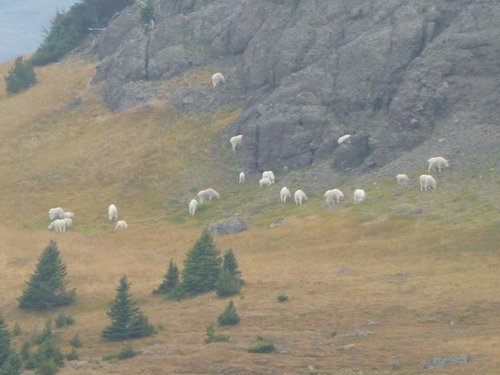
The trail started to climb pretty good after we left Mill Creek and we started seeing mountain goats as soon as we got to where we could see the other side of the basin. We were about 9,200' when I took this picture. Lots of different groups of nannies and kids. Not sure I saw any billies. I didn't get any pictures of the goats but my buddy did. When he gets them to me I will update the post.

Here's the side of the basin that most of the goats were hanging out.

t-SCo6VFBaM4NQoNWuJjSRmT1zkfUHYLekyIew7UEu9orm2-qYrqVc7AHHBRUSMbfWFjzZo6SSl9caSNlZfYAk69bUUnITLjsy7EZZdVPqZdzsTR5YKTQNQkM8C8TBN1NW297w1pRyrVRuu62m7Jkt2tKF_JSmcAv2nR3ofzlQJCuVBg9B2HPMceITRa_WIAqFoSSpUv9-Ni5iBopDsXs04HNQG6Bb3z12Ag9Yw43cYTqQUz4KB_U5eFip4AGBqzuPw50YpsAnRmFR3YnbNSqS3aRlZhVTdWbMvaXM0Ojsesbvf7HMUi_LyeNbrINKFL2k_cDtWJo4adtd5HzkSf38zVAmSvA_6-7rbWUtDSw1aewOt9xFr8HkbVRpMaMRzOxRIJxG7KXKrH1Lb2JnyOWOMAjR2R0cJj4eW_Yb2p1eSVixZX6NnuqOkSIFsCQB0pGCSxaB-SZ7dZlOsOrgzizIS_zMpjCRK2nk9ez-sSSfaGZPUKdnNqGZqqQ1nEpln-a82OCBtuhzus4hH-SR-ohTL1XGLFRlC75ef3ysUg95PKkOoliKSgRy2eylE9czCch8rZMkHh1yOACwe38B8SbHcvNaujhrV0KJWUJ-C9g7VroEfZxwmHTijV=w1267-h950-no


Continued on the next post.
 
Last edited:
We kept going up the basin and busted one raghorn bull elk out of the timber. Not sure what he was doing in there by himself but we didn't see any others.

This is looking up toward the saddle that we were going to cross. I think this was where Rat Fink told me to cross. There was a very easy saddle to the right of this but I couldn't figure how we could get over the top from that saddle.

If you look really close you can see the break in the cliff right at the lowest spot in the middle of the picture.

MXZ1kSuGXQAw3mFZNCCyT0xarmRvMDmS9QdItDv2Tib0F6A2U-yNmJ81rhuVmMv-6_wBzzLuoOm_hUy6LrV9HMsj1HE_sN92kgQemtL3KZquyQDo_K9fmDFzRTEv74JXBoOEXONB-mt3bkUdntU-N28B0q2FdKV-K88-ThR3oh29YeSwXvIhON5HykVHDufGlYD86BVcsn6Xc-UC0NqP7fmgJtD4drKXbsa3nzHm2eK6k6JRwAhFtCaJ8adfB87ZziikVb5OFvLOG7ivtQYUMM-7bwlrdnF5blqotQsllQQNFvCWlXjTkhFKOoHdNjolxaJY21m8jVl2SYmXUBEvteVGlZQZNbrIBMtQ7pgNstxQXrHM0YO94VMcpnU4r0CNwgctK8lBZyFToQAjkBQd5pSqkc4DXJZDj0Nn1wgd_RqxYt8DoZE0CLFtQ3ZYHNNxkR4d7UJJUkJeYgxKzG6Sxoyp3nVeG42TyysaURhi2UFraEjkUS9vqTpBf3On39WZygB4HIDZ2Qc3PbbcVN2Cz6DEv5FG3-2NcAzFINtdgfATYrmLCFK93xAlGjqTAHmmHHCtT4JD201PqNNkvHZRwy0fGBLthzHRHtTCIEjjHzIztMIOnpzanwk9=w1267-h950-no


A little closer picture.

gUReJm5jYj0GTvsQytrNaOran1WxUrlmkuRU_fAPbgt9Gx48WP-JzQaH1s_z8NlPlAnq-ZamuMYVmF-bbVkBoFYdKS4trY3Nzy5XrCYmIwskIIROVvLsQG9eWzlGWqPXbNcNmvb7MOVUOSjDQbFxjeSxuMMRaWzDR7ys7P81_Xm0O3GV5HFgXT_I29nXdHOzdk-PB_wxv7Jc5rXsiTHCBqiK2U2KCHnGt-D4a02InmHQRKo0jq8G-x_3D4m2wyFRowVLiCM9SLjJHq5F5V4X04ggdaxSWM8FYJ9Dsk79ncbS2Nzc8iEVxI_62z4qkfW5PIaUwziY-LD1KMbQMbxohNfRYRXLXKQbZj5KA84KPmW3KVt7t3pDIc6kTeP91JTB1Z6MhDJuUWSR03mdXkm1ryohXiqfwFxcmwz-Ngwlspt1QJFvfEmnjcaaqahE8SN8iaQgviGiDmLX6RIg0dsljJChy-LqQC3WDqAnE5OhPGtdBUN-vvrJ36KPr9dd8X1enoc5DBBGMf-NxAVr3e8XTmjmWAADvpJpEufjby7HK36SsVYA-3k_Y8L11nF7ugMFYNV5Ev45IUeEGitEis0P2-bAQA6z7gz88-CA_jcoujKOIWi32eMTJW_j=w1267-h950-no


My buddy climbing up through the crease.

WLQDHMYZ68I7_CpgpirQPbvsEaaEtnt_H9e5gODF8TqOTNQ4Ktnv0mvQq8qA33_NNE-1KyzOhPJKL_HIn325h1Kj6d5A4bbUdIOQ2A9DwiQ3qosQY5_ASfkG37FtbBF1L3MlSiX84P0qhBH2Ugf0Ew3z5FxT-R-eBsHc2SVzdXnAv8U9EcuG1ZFq0maf2ro0ewNFs5ZQbOPmeH30-8jQuxQMeoiU8L2kM8EgFpjqDLtSmnAlDdvIEb7mVTJn3zJcpU7cO1cZoseAry--R5xQeLL9lzJXE6nYPnMFFt4Ks2BGRKeMywkIVa8rVKk5QMoqfhix7xqyQsG5L0khsrSGoB3-e9lF7xZhkwP1XJ4bw1GOqUg4m1gQX6c9q-lZbe7wYjSGnCyID09PEsteGy69LFfnBufYPkrB7PmTEoQt979px1QWeqmHmMKjlVL75V5M3Yp_553yevF5cWGDnsVQcAAxBjdYmqhLVIzzYA72Vxjl48icdZki1fkCJKvVDjjiCpJzrjAdxEWZJqQ9-MDyiGuXq_doLQxKVGaozLJajACwf0-za78Omo0K0smYoiLKLTLPLHOxHJprm9daLEeSYEQvp-ojs8k7SC1OOgRHQ2HCkhNJb44j=w713-h950-no


Looking back down into the basin from the crease we went through. Sure wish it hadn't been so smoky, you could barely make out the outlines of the mountains to the southwest.

THagr0m2ODtplhd53La8Qfi_CNGml1QSflCmpcPtL9nLx-NXuFrv5ddhMQRpBnAm-HexRBxGr5AASBqYiI4mtgXwaKUIFlGRy2dyzV3OH8cKb-Q6MLFlV3fzEMCus9K9D7uJGGAWPSEKJZGdl7AMK4oEYXrlfYaDw7IxS244y-1vCqsLhmM_gTzSxTnU9d4Kt9qAhGii5Wz8dEreYmjvJ9zDrh-RkA1ryh2FymkXBOdj_QcAEbYrgDfo1Ogdadl72KopdlFfYvDdO7naiePkBdQW9k_-cxUHcmIRSptzl2e5yCTQaxqA0CoUzkqIDR25uNa8dzkpw45pOMUKqc3C_Xui2Q2ptjx3bczWeM_szMTeVaddYPuvXELMihfmMbrmg2odGoL2zSws-CsObbGMjMZnu2nCQsYQoBBsf6lxykYqWSUvMYIdZGHmD8JxP7WSgBTTRPsC8ByDR4l1OWH5yHK6BV6aK1vFxa6-2A-mCmAlqyykquJiu53PSfLYIOJp-sm0-jqIsRocNRjEicBGNrYop_UZvpsp_31A1LGLaXc-yhkogkiENayaS8cKnRLf-IpvXK4Jbpu7TM1nc7qysfCOfmp6I3btXs8ckXMJdrz4aSc5zn1J=w1267-h950-no


More to come.
 
Last edited:
Since we were already at 10,300' when we crossed the saddle we decided we would go ahead and climb up to the top of Crow Mountain first. Here's the view looking down on the lake. 10,721'.

Lx12xOebxCFb9KnuaX1i9O2yU2FfTz5bJmq8nb51dEARlgxmMUge-hS8WlhXGw6dajFYSMl2X2nqktNVRa7TEW-vY1rGwmssZUxSI0-0DVwPrE_YLL9_Ppm7gM8nZOAVVHznOyLkR5zPoCTF_Fc4S1hZR_W1nQQJ_RLVtoUc73fAgXpRuQq95HVNUmQb2-fIxBgpcUGiYGfp-QNgYoMrnBfqxhVjvfX1GJeFDFT1j-u29rXEDswPa95LpZARzRFZL9bXPOeYn9P2gPOGlN_VhOmqf82dxGmq3svLH0lbxDKuyk5vZUzhMyN1CP9M5lyJz9HEAsDGpmqxMG81Xp5T9Jr-zenQOFOdOTVmJHmaDLoY5nzrpC9umcMI_8M5on5p3HCQDBF1WehBsHm8CwL0O_Fz_Ku4QxiqRw6h_2H25L_jEXHw1c7yjbtch0tlnhn7Od1XYZXIpd9o-m7X1-uSB_mUasSzDoKN-V8DFMJGru8EFXBGD0PMQA1G0svhhWvHRwUaqrexVvyMhseuzdqh4gEHNTje5Jw4No98UNq5ccD-_dQ9J_BjJpukB2ts-jsh0w4nSGa4RB3PwOr32hnOYkWLmgtUcnBRaSHy6MGozA9VBzjsZOJ93Wx8=w1267-h950-no


Not sure how the panoramic is going to work, but this is a panoramic from the top. The left is the basin we came up and then the right is the lake. Again, this would have been a spectacular view without the smoke. It was good with it, but I would think you could see forever up there on a blue sky day.

DDI6BlGOIpAs7rhwbsxjRu7kBSUqzFDuFt1RIOun1TqHJZEHdmjDdoulIomIcBMTV_3T0gNO1DZiPMvUuPwOjYx7EGbhSn_KAB5AvNj7rXPhj2VphmJ_ERg6ijtWboZeGSohvazpunRmMzftB6aQ34G4Dyphoc-gA_IR_kcfj5fujlAmx12H0xMCP645oxdnvqcJ53FqsGDXoU07qSNc4afPVHBuEu8T-of8hy8D6gP0qe7K998XEf35L55tkwtpjl0W0PMljq0QNb2zYAF8Zc4lUR0EIlscd99illk9xfn1QQDmTCP0nbnQIzTFrlzWopDz9KpUZdMCduJb7neE5dTEiq8Pbo8tBI9ePiA0KWrMcgF0O9me1_GCdwYjktpNcUOd9jV24T8yan8DZlBnOT7kJ5Sj8M5vg8yCeU4R0JUkPHnOUxLIM6_GoBy6CHV9fEmoKYJsTUDzGErdoAtOUtmVB4EhiHQloIB-ba6SOC7mpiRCTVRpOXzxAimkUefKeLybXtlb88CTediwITvViE31WG8--KlfpmwmkiWj2Tlmdi2GDY2MoF0x5bQchBlSEXhJtnlB4ijMy3WHVEzDbPHYxTXRK_yzvPhdvlCg4D7vo7Mw--nydo2U=w1920-h434-no


As we were eating lunch on the top a guy actually climbed up from the lake. We saw him as he was climbing up but I don't think he saw us until he broke over the last little ridge before the top. He had 2 buddies down at the lake fishing and he just decided to climb up to the top. They had ridden in the day before on horses from the Boulder River side. We had been counting mountain goats that we had been seeing and were up to 18, but as we ate lunch and looked back into the basin we had just climbed out of there was a group of 19 goats and a group of 5 goats about 1/3rd of a mile apart. 24 goats visible all at the same time. Seemed like they were all nannies and kids though, that basin must be quite the nursery grounds but the billies must have been somewhere else.

We went down to to the lake with the guy that had just climbed up and took a few pictures. We didn't have much time to hang out so after about 15 or 20 minutes were headed back up.

Here's the lake. The cliff was in the shade at that time of the day but it was pretty impressive. Straight up and down.

UPCvC0Tpu0iJinF3-yys2mZSLso9Kq-wluIU6L5ryts6-Zw3jg6V5EIgjs-Y2Lsu-BI44uq9c_3YuYpW3LDUEROMz2KLQ89QA-OfHsDmyr9vJH7kPUqfvXJfdzaFS-NeUxTwkujhX1VdWxWbQ9qYxDjDxZEO18BLPokc4cxWEXRxeMkmYdySS-w0r2NpPaIySwzrN4keAIDv03y3BTL-oplvi1O0FQP6FdKU2J8P_NJ4WWG52g3RDPXG6z-jtKxTlj2xH5tpGeWyVWHNP0OxOaKymQ7ayOdiVjPBL-_0QRpnMOSN63KYTbMCxOPULhCOv8ewjI_SO2P4-ZeJwE3T4cwiMskjpq2yWd1reh_9mR8w3lbA8l0bSvKJNB-LllX3p-8RF49o8a1ZWw9WYPUwJu2K8Xzfn8kz8rc9mzzkKUj5b-Vdvg7tA-TvUhneOhLxtBcwkQz08ogwQKEejCVkhT_ZsbfpRUkgyBqV_ZXoGcPibAq3Mc6iCo9bm70CLvBlnJzUZr88sMhpjj0gCjnLXC-aaJfJ1VcmmWTBflfVuIvVADsCQp6G32MNf9QWb7Rl0_k57eKHHyVYHaNbfLJ3aPO837v06dpqectflTWXna7Iu1dv2-pA-EiS=w1920-h608-no


Here's the saddle we had planned on crossing originally. I think the way we ended up going was easier and shorter. Thanks Rat Fink for the tip!

Z-P4NWghm-2JdaFv7ngzcGszyLCe02ogmQ7UeSbvSiYoVya_SSlx3PHszYfCziM2RguYVbZqctK3wa7IshD3xngz8aOCfXhqbK3ehHHX1j-dDMNkyjlLZUAw_LNrv6sOuoiZ34HUU6gRVmOPWylunulNtbcp_GuBGR3gQ9yOnaDFSXUvbNxk8n79NtW0FJo3_I48-zU8ZKj989vbZOfRMfMsuuzVGaFNbjJJrZ1liJVqZGU0HNE4BUcUeJHkZwvnuG_BQHa2KifE5BsptVewqZASBUQngXXwcAB0oTheclaYRVIGJH-y7rdYm6P75egfGJTUyscq2PrQptEmjXm_vQacoscclTrVz4giuG1uhIPVw-i-KMQBe-qJurH7O5p22VxT-ITOCCBLet8OuTLrzLfzi5suCW8gmMVkJDdyBVtbFR12HKAGz4CsJTZ5LJu9q82YE3GNPAB1Ax-VBLPJRGOl41PV-IydgYoimonriiTqVvhtJsufV4vuZdAAoDJh1ApxQcPs7CviqNzaTJJjRBXYuLfa5QA2gK0uarcycxBvCjHi1-lej7YP3wpaxsw2EvcuVwQ_XqaA-XjMpf3dEtPhy34I4Ab3wIRF9sTkyUBcpg5KImE2xr5H=w1267-h950-no


More to come.
 
Last edited:
This is the route I think MTTW was talking about in his post. If you look at the panoramic picture from the lake there is a big squarish rock right about the center of the picture to the right of Crow Mountain.

I think you could get down from that ridge to the lake without too much difficulty. At least it looked like it in person. On the Mill Creek side that actually looks like the easiest way to the top. That saddle is a little lower than the one we crossed as well.

Here's the Mill Creek side. Note the big squarish boulder on the saddle on the right side of this picture. You can match that up and see where you would cross over on the other side. You can kind of get a feel for it from the panoramic picture that I posted as well.

LMEKRWq2llF7V-H26Bb5xsodymCe6g413CxW-PszhN6M8pC-_NPz6piKXLTfomWWvC2IvSsM4surD5HMC6hWIbifmvSvTdcNW7GIabQHITrr2_WK62IsxSe0Jc49cY7JXCH41lBFSWLrYv64wQ-5sQ3FMV8eW_hOMkzFv6L5nWBTxpjyVesBXp-BFGNxq1ecjMzgVzy7Vh9zJOEHNfTjF0wS_VJyCbd-9gZ7f75Hi8HDqdy2GeG8edBn6LbB8Ae1uflcTqmt5cTbsR1oFHqi1VXqAVlp4g7jCD4xPZC7d2O4J1P6W1meqTuqLGhRVB84oBkqS07PG7DVGHD96YURzK2vto4MiLzFitefJjS2dedEdL2gUpBVgzkGP3fQGOHMFVnJ0Gf-xR3d00jYwXgk4GmrCY_txFVYBfja3Z-V8KVSUUnyLt1VH4aCPb4w5_2hzUc1uUcIHIaYBC340e1mXPcr_XEzZ8SRf2x80uO3Iuw_bsKXEFqb6flhYmf_nufOTsNukeVQGsSk1QgiwTLQ1ib9EvcyQIxmAj1nxeKohx0TOy4DRPTxG5kuAjO8luvYb07SAWkiQU1Hl6YmCwMPdKxPilwzBoXftyXpzUyRGUkzyxwToW76ILKv=w1267-h950-no


The drawback to that route is that you can't get to Crow Mountain from it without doing some serious rock climbing.

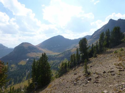
Heading back out of the lake and to the saddle that we crossed over this was our view to the southeast. Some very pretty country, again, it would have been even better without the smoke.

gXvZI1sVfGSj3AEb8jpNMR791mQDD0asaCZW6eWw9zYMagHuBpj-fM9QZeNAl51pRNXDfwTl_79hU6-YZ3dxfmzAaZjDDq9AMnDlml6vgRoJWxxojQrUlIdV9B1Ndm07KwconfLxVoIlUhqkP_KLdmrdRdQ6s_KF_086OdG0klqNFt-bJW4N_nZBdhnE8Cc-cxz78cCxG12xJ3kn4iUKWkP9dYOGd779kuBqhwNPVZ4FJkAgxN1PxAx2gH5jBJ6dL3C-MmDXRbh3bTz6zU9fzw9jEVXhWwmIen2FubbpGEXL8dFK6lwBqAVCWQeGl8__TT3S28wdqR7xufQYdy0PF9_C_713gd7xZ6ROnE3SR4YPHQ1_ENb-uw9pwtIUqFNuOMXj_dG4CqKMNhGSF3t8IfLu_IY-Nw2QPd3RQereqe_TTQ00e4PE0ndCa-Qky41mPj6OU56quPgZ1ecfdB9fRLb9Th97GIxgq86s3iOl031YL5c0gL2PhPgAhksP4F7oDt-U7vkkJZKG22kxIZJ3mNJOmOUcOa721WDxq1KHNAiDJhKVMHqCvwi5TV5XBL-CzhDfHhMltA2wuxcfH29ugHOm3NDyURcD9G97eiQ14GYalg_o6hqfW79c=w1267-h950-no


The basin was just clearing of snow and it was pretty much springtime there. The flowers were waist deep in a few spots.

j5Ym_PJithNq0aSL4ibwtz-DoK9VFXleKkhKkcEgsdqFuGGpkgoY2ITU35K7GkoVdLVmPhjFtSw0UISjCrTpEf9_9KMJhdZCBycoBngLCl5C_H2RFmiqr3FfSH4y3Sk9aQuDkHDd6vSscLPESKuxxDpCGtqeT5iXcLtCC8aRLoYhYAEYsoNNbdQByhD5nXSEOj6ImZsYVoPADCNYfkBOb-AMLhDByMOxVhjSJ3CFtg89lfof3EF8Rw79aQIWxeoOjEb3yxI9oKF9FcTiVrTSZ2bNscS-9WASvkhKxjA-UXJVY_5ubOq9Zm4MPu6SZN6Yg80kQ2ILRAdzhihie6gaRxMLjM14lGpE8_s3pq1_TGz4InlVvsSfxwa9kMrwL5B2IkkQ4MFpt1eRWNwSUpVrsmYPFuzQ0iEY9_l0jmW_gCGyhlkEKX7vdyKxaP-delMXCbX2xgJCIqZSLueKhpaKeBiCu3k0Wh9aUVoAqnBqFBvstCOEriFMBH_9djWTfocFTXdBM5q884xXxX4yxjnL9oSE7BmiF-6E5AVfTCjt5yRw-Tcs-JssrE0xpdcRp8luUcewvZm3YM-k-GoflCejq3Zrr7iIDRxDgHaekvQJD88ztrXPtCFF=w1267-h950-no


8rITm31kn1RKvijxClsiRMgmzz5zGu92ekn8dm4Vxeezuo6RnURFLOSWFvPpgKJCiwtERXKQlM14msOSXm8oM-_D8jEpVuh4SWR7ZXJVy72NHNhC-l9Wp12T9DBIynhJvrwIICml_Yqa-sO9LMX_YuwcQa3DB-Ty0qhHS6yp905pUlDi_FsnEzb-G78kLR3oDqKCvbkgtyiBoDhAyrEG70bQgEE3-3ZJCZ-gw4E6pQb_UMG7ik5RGXPSrG0gtYQBIpnZ9LeQyw5i-5AMlgo4rTJP-fIU_UdZeOGm8NRdk3Z3azT3k45adzn4awUwKJ5fUXqazgzJTipaTSy8ggEbOUrTZf7G8vn5_JCRFS6Axp6N__HSoBPgqwV5A6OpOmvWhyXYILh1gqZE4FaAwWNluBUbjwOD0gwQpFQ3LNZG3DAv4soYFBbG4XCApR8NDOCxtWphKjOvJ_bbGwvtMiUaJ3dNbMbLGxy3f7m6wK5W7_4-F7yz47X6gqi-EOid4j5QDWlB2hqoMIqwBzA3bzrwo49vBdr1PLJvKGSlC6c7ZVsnDvZZrwIMq16gm-sUO9oj78-IavP3zT2HSdCoR29PpnXLIyZepBwhnnrFGhlJjMcYOGMNqjrQdIvR=w1267-h950-no


Pretty good hike. The lake wasn't as pretty as Pine Creek Lake or Elbow Lake but seeing all the mountain goats was pretty nice. I will add pictures of those when I get them.

We started hiking at 8:15 that morning and were back to the truck at around 6:15 that evening with about 30 minutes for lunch, 30 minutes stopping and looking at mountain goats and maybe 15 or 20 minutes down at the lake so a pretty good hike. My GPS said 14.21 miles and 4,997' of elevation gain when I got back to the truck.

Didn't see any bears and really not any sign. I'm not going to complain about that in grizzly country though.

I would give it a pretty good thumbs up. Was nice to hike somewhere I hadn't been before. I thought it was a little harder than day hiking Elbow Lake, but my buddy thought it was easier than day hiking Elbow Lake. Both of us thought that Pine Creek Lake was easier than this.
 
Last edited:
why can't I see any of the pictures?? I've tried on a couple different browsers and on my phone...it shows a file was loaded, but then there's just a big blank spot with a "minus" sign where the pic should be.
I can see the pics that I've uploaded to this thread, but nothing that anyone else has posted.
 
Since Photobucket isn't allowing sharing anymore I switched to Google Photos. When I first did that I couldn't see any of them on my phone and then I loaded Chrome and I could then see them in Chrome and Mercury. Maybe you have to be signed into a google account to see them?
 
I tried on the chrome browser but that didn't work. I don't have a google account and don't plan on creating one. I can see photos on all the other threads (probably posted by different people). anyone else not able to see these???

I guess I don't even understand photobucket or why you need those services to post photos. When I post them, I just upload them off the harddrive direct to the thread...
But then again, I'll be 40 this year, so maybe when my 4 year old is 12 he can show me what to do...
 
I tried editing them and fixing the extension. I think some people can see them and some can't. Can anyone see them?
 

Latest posts

Forum statistics

Threads
114,178
Messages
2,046,961
Members
36,487
Latest member
therudder
Back
Top