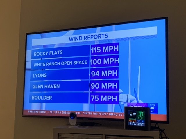
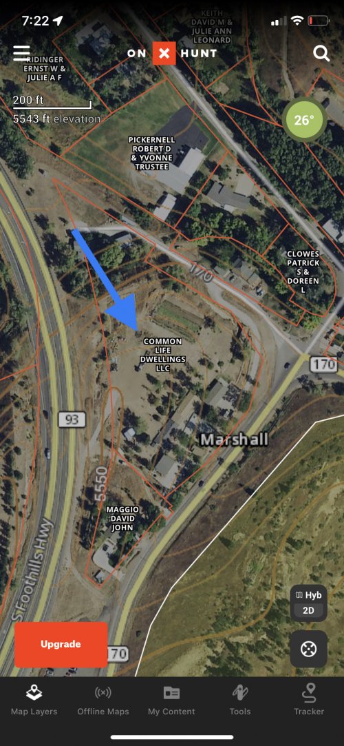
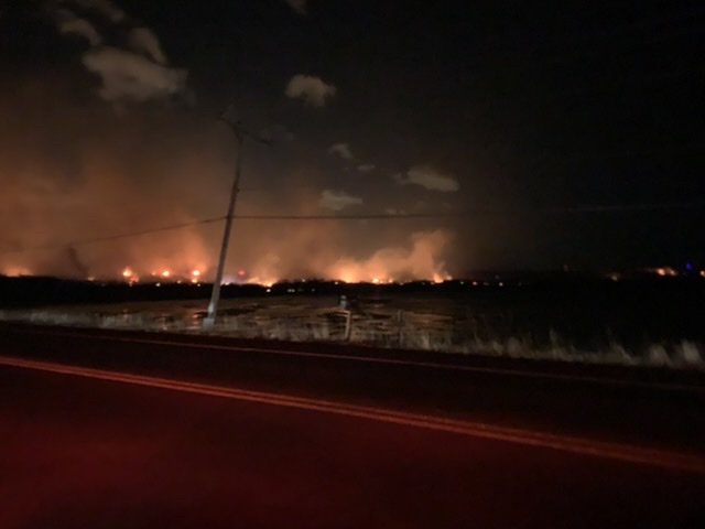
You can look at this map and toggle to an aerial basemap to get an idea of how it spread. Clearly there was a lot of open space that allowed this thing to pick up steam under 80-100 mph winds before it hit dense neighborhoods. But with winds like that, it didn't need much to spread. I saw a short video from source of the fire shortly after it started. I'll see if I can find it.Amazing photos and sad for those affected. Scientifically speaking what do the spread patterns look like on something like this, in terms of what structures burned and what didn’t? Just basically everything in the path of the wind?
I’m pretty familiar with wildfire dynamics in forested zones, but not really what I assume are essentially subdivisions with some grasslands and mixed urban in between.
Navigation
Install the app
How to install the app on iOS
Follow along with the video below to see how to install our site as a web app on your home screen.
Note: This feature may not be available in some browsers.
More options
You are using an out of date browser. It may not display this or other websites correctly.
You should upgrade or use an alternative browser.
You should upgrade or use an alternative browser.
Boulder County fire
- Thread starter Oak
- Start date
Here's the video that appears to be at the ignition location. It gives a good idea of the extreme wind at the time.
R
rwc101
Guest
I lived right in that path. Crazy to think how quickly things can go from a grass fire to people losing their homes.
The fire we had here was pushed by 45 MPH winds, nothing like the 100 MPH in Colorado. One of my neighbors tried to stay to defend his home and almost didn't get out. He told me that the fire blew right past our subdivision and exploded into the mobile home park to the north. igniting 150 mobile homes in less than 15 minutes. Then I came rushing back into the subdivision, against the wind, almost as fast as hid had been going with the wind. Fast moving fire cand do some unexpected things.Amazing photos and sad for those affected. Scientifically speaking what do the spread patterns look like on something like this, in terms of what structures burned and what didn’t? Just basically everything in the path of the wind?
I’m pretty familiar with wildfire dynamics in forested zones, but not really what I assume are essentially subdivisions with some grasslands and mixed urban in between.
one ate E grain
Active member
I saw the one just E of N Broadway on my way to work at 10, looked fierce but I guess they got it out. I was working up Middle Fork Road on the way to Lions and one had just started there when I turned up Middle Fork Rd across 36, there was already a fireman on it but the only thing to do was watch.
Working I told the homeowner and he went down to look. I wasn't real concerned as the wind was away from us, none the less that Crestview subdivision only has one entry I know of. Wind was howling but the trees I was working in all looked ok. I always watch through the trees (fire last week out on E Arapahoe) and I saw the Marshall fire getting big, same with the Middle fork. Rd closed back to my usual commute so I went home via Longmont. Rd goes past the North Range of the Bldr rifle club.
Smelled plastic burning when I went down to Baseline for groceries out by I-25. Same this morning, thought I'd burnt something on the stove. Today phone ringing off the hook people with wind damage but I'm busy forever anyway.
Snow now.
Those winds and super dry could do it everywhere. That fire off N Broadway could have blown all the way into Gunbarrel.
Sounds like no one got killed which seems pretty lucky.
huntin24/7
Well-known member
That’s terrible. It’s hard to imagine that many families losing their homes like that. Devastating for sure.
Bigjay73
Well-known member
Somehow, nobody lost their life. That's a big fat silver lining, at least to those of us not directly affected by the fire.
woods89
Well-known member
- Joined
- Oct 27, 2021
- Messages
- 821
What a crazy set of events. I have a lot of sympathy for all the people who lost homes.
Hard to believe there was no loss of life in those conditions.
Hard to believe there was no loss of life in those conditions.
Carl 9.3x62
Well-known member
Insane
D
Deleted member 28227
Guest
Just found out my SCV coach Mike Friedberg lost his house + everything.4 inches of snow on the ground since 2 o’clock today. Hopefully that will get the last of the fire out.
I’m glad no one died, but f….. and in December.
Last edited by a moderator:
Bigjay73
Well-known member
Couple that with a dismal housing market, and these people are completely being kicked when they're down. Families will probably have to move to new areas, disrupting the lives of their kids. Multiple layers of tragedy
I’m glad no one died, but f….. and in December.
Unfortunately they are reporting 2 people missing now.
The count is now 991 homes destroyed, over 100 damaged, and 3 people missing and presumed dead.
If you would like to make a donation to those in need, you can donate to the Community Foundation of Boulder County at this link.
If you would like to make a donation to those in need, you can donate to the Community Foundation of Boulder County at this link.
Addicting
Well-known member
Thanks for the link, it’s impressive seeing people be so generous. That is a heck of a total so far. Donation sentThe count is now 991 homes destroyed, over 100 damaged, and 3 people missing and presumed dead.
If you would like to make a donation to those in need, you can donate to the Community Foundation of Boulder County at this link.
Hunt&FishCO
Well-known member
- Joined
- Nov 5, 2020
- Messages
- 284
I live about 2 miles from where the fire started; our dogs were at boarding (Dog Tag) marked with the red  on the burn map. The fire happened fast; one dog was evacuated in time the other somehow escaped and was found a mile away by a Good Samaritan who got his chip read amidst the chaos and emailed my wife. We were in the mountains and had no idea what was going on; my elk hunting buddy texted us as we sat down for lunch “do you have your dogs?” Eery just thinking about it.
I also pulled a screenshot from OnX; that shed burning video is from a property that is a commune. They dress like quakers, but in that area they always have heavy machinery for some reason.
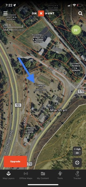
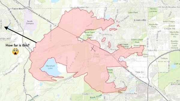
I also pulled a screenshot from OnX; that shed burning video is from a property that is a commune. They dress like quakers, but in that area they always have heavy machinery for some reason.


Attachments
Similar threads
- Replies
- 40
- Views
- 3K
- Replies
- 46
- Views
- 3K


