Gravelyctry
Well-known member
is there a good/easy way to transfer waypoints or trails between users? Sometimes my son or I will want to trade info, and I don’t see a way to do that? Thanks, Neil
Follow along with the video below to see how to install our site as a web app on your home screen.
Note: This feature may not be available in some browsers.
Click on the item you want to transfer. On the dialog box that pops up, there is a red "Share" button near the bottom. This will allow you to send that item via Text. Super easy to do, once you know how (even I can do it).is there a good/easy way to transfer waypoints or trails between users? Sometimes my son or I will want to trade info, and I don’t see a way to do that? Thanks, Neil
I just looked and when you click on Share, there are all kinds of ways that I can share a waypoint or whatever. One of those is "nearby share " which might do phone to phone locally, and there are many others that I don't recognize (e.g., quick share, and others). These may depend on your phone's capabilities. Just explore a bit.Thanks, Brent, that’s good info. We were trying to link phones or Bluetooth directly somehow because we don’t always have cell service.
We have reached out to Fort Riley in the past to try to acquire that hunting unit/safety zone information, but they have been unable to provide it to us. If/when they make the data available to us, we will be sure to get it included in the onX map.Hello @onX Hunt I’ve drawn a very low odds tag to hunt elk on Ft Riley (Kansas). To access the post I must check in with the iSportsman website to determine which area/s on post are temporarily closed due to training requirements for the soldiers. There are permanent no-go areas (weapons targeting areas) as well as weapons restricted area (archery only, muzzleloader/shotgun and non restricted areas)
There are also deer, fishing, upland birds and other recreational activities open to active duty, families of active duty as well as non military folks like myself. Please take a look at the zone systems and get these zones to show up on my OnX system, it will make it easier and safer for all recreationists on the post.
(I presume that multiple other military facilities have this same opportunity for more accurately showing map related issues on my mapping system)
I greatly appreciate you responding to my request. I hope something can be done to improve the mapping system and keep your users knowing where they stand.We have reached out to Fort Riley in the past to try to acquire that hunting unit/safety zone information, but they have been unable to provide it to us. If/when they make the data available to us, we will be sure to get it included in the onX map.
We will try to send another request to see if they are able to provide us with that boundary data in a format that allows us to upload it into the App.
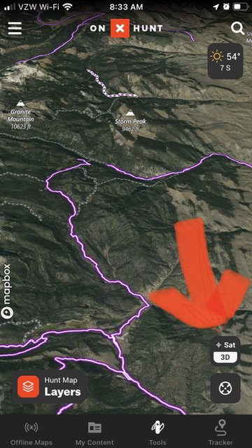
OK, feeling stupid here: Sometimes, when manipulating the map, I do something (unintended) and my view shifts from looking straight down, to looking down and out to the side, like I'm in a balloon that is only a few hundred feet above the ground. I have the hardest time trying to undo this view. How do I get back to the 'looking straight down' view?

Ah, the little 3D thing! Thanks! It's on a laptop and somehow, I'm toggling to 3D with my mouse, but at least now I know how to fix it quickly...
Are you hitting the wheel? That does it as well.Ah, the little 3D thing! Thanks! It's on a laptop and somehow, I'm toggling to 3D with my mouse, but at least now I know how to fix it quickly...
No wheel, but it's one of those mouses where a tap on the pad equals a click, so weird stuff happens sometimes..Are you hitting the wheel? That does it as well.
Right now, we are looking at Android Auto being available in mid-late SeptemberMy buddy's Apple Carplay (or whatever it is called) hooks up with his OnX and vehicle screen. The Android version just says "coming soon". When is "soon", I've got a OIL hunt coming up and it would be helpful to keep track of roads. Thanks.
Thanks. My hunt is on October, but I am heading up there again this weekend. I'll gladly be a beta-testerRight now, we are looking at Android Auto being available in mid-late September