MTNTOUGH - Use promo code RANDY for 30 days free

Why I prefer GaiaGPS over ONX

AlaskaHunter

Well-known member
Joined
Jan 20, 2017
Messages
1,887
Location
interior Alaska
I have both GaiaGPS and ONX.
On a recent trip to North Dakota, my Alaskan hunting partner proclaimed that he also has both, but prefers GaiaGPS.
I prefer GaiaGPS for my hunts for the following reasons:

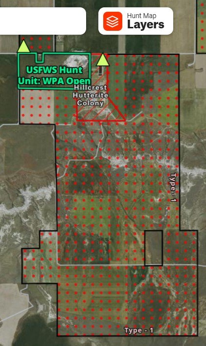
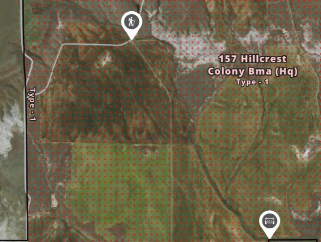
1) GaiaGPS uses a perimeter outline instead of polygon markings. Imagery is clearer in GaiaGPS compared to ONX.
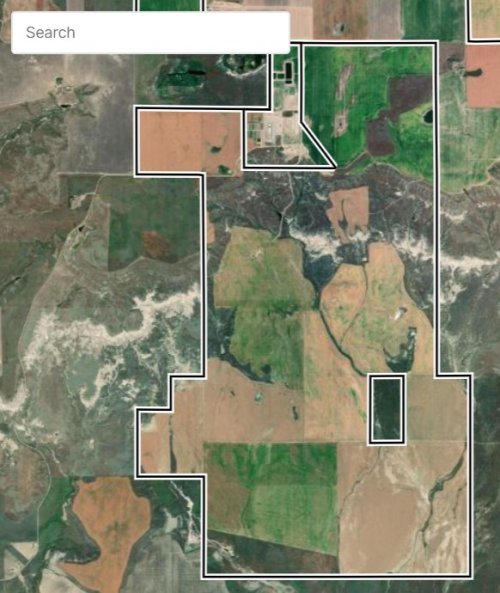
GaiaGPS.jpg ONX.jpg

2) GaiaGPS allows the user far more waypoint symbols and the ability to annotate those waypoints.
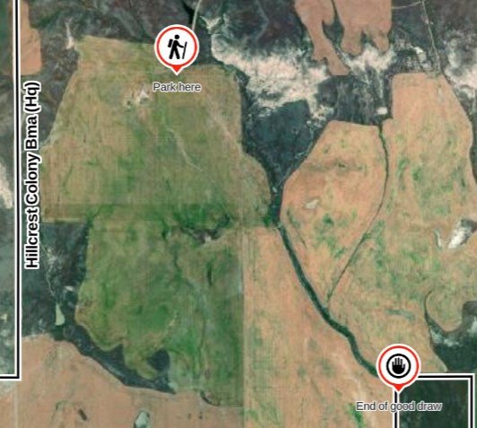
GaiGPS_waypoints.jpg ONX_Waypoints.jpg

3) GaiaGPS allows the user to create a hierarchy of folders. ONX has only one level of folders.
For example, with GaiaGPS I can store waypoints in a folder DuckHunts inside a folder EasternMT,
inside a folder Hunts2022.

4) GaiaGPS has far more basemaps including most recent satellite imagery, high resolution satellite imagery,
many different sources of topo maps, cell coverage base map. ONX has 3 basemaps (topo, satellite, combined).

5) GaiaGPS includes all 50 states for $40, ONX charges $100.

The only thing I prefer ONX for is they mark the locations of boxes for block management cards
in Montana Block Management Areas.
 
I also prefer Gaia. It’s a little tougher to learn to use, though, so my hunting partners still choose OnX, which forces me to, as well, when we are on hunts together.
 
I have been on the fence, but you probably pushed me over. Going to let OnX go, since I can get almost everything from Gaia (can't find burn scars). Have been using Gaia for some seven years, a great way to convert your cell phone to a very good GPS.

David
NM
 
6) GaiaGPS has Apple Carplay functionality. OnX Offroad is the only OnX app with Carplay, and from what I've read it lacks some of the OnX Hunt features.
 
I chose Gaia over OnX for quite a while. What ended up pushing me to OnX was the fact that Gaia has a layer for the WDFW private land hunting areas, but does not distinguish between Feel Free to Hunt, Hunt with Written Permission, Register to Hunt, etc. so I had to leave Gaia and go to the WDFW hunt map website to get that info. OnX includes that detail and also has a link built in to take you to the webpage for that plot if I want more detail. That alone has been worth it for me.
 
I've also had both, and prefer Gaia by quite a bit.
 
Same here, Onx had decent basemaps at the time it came out but any decent free app has better options now and the far cheaper Gaia or caltopo/SARtopo premium options blow it out of the water in functionality... the only reason I keep it is to share waypoints with friends who don't have any of the better options...
 
I used Gaia for years but started leaning more heavily on OnX during this past hunting season.

I’ve found Gaia to be buggy sometimes. Lots of half finished downloads, for example. There was also the issue that they didn’t put MT’s new hunting district boundaries up until the season had already started this year.

Word is that Gaia went downhill fast after they were acquired by Outside Magazine last year. Customer service used to be super responsive on aforementioned bug issues, but weren’t as much this spring and summer when I start thinking about hunting plans.

The NatGeo layer is a great tool if you’re in an area that has the maps. It’s one of the main reasons I didn’t just cancel the subscription.

Hopefully they’re regrouping and improving as they do have a great, albeit sometimes flawed, product.
 
Does Gaia have an off line feature for when you don't gave wifi or cell service? Does it have a web version?

Never tries it but use these 2 features constantly with onx
 
Does Gaia have an off line feature for when you don't gave wifi or cell service? Does it have a web version?

Never tries it but use these 2 features constantly with onx
It has both, yes. I believe there’s a free version you can play around with, but you can only view a single layer at a time, and some of the premium ones are restricted.
 
I chose Gaia over OnX for quite a while. What ended up pushing me to OnX was the fact that Gaia has a layer for the WDFW private land hunting areas, but does not distinguish between Feel Free to Hunt, Hunt with Written Permission, Register to Hunt, etc. so I had to leave Gaia and go to the WDFW hunt map website to get that info. OnX includes that detail and also has a link built in to take you to the webpage for that plot if I want more detail. That alone has been worth it for me.
Good point, though I wish they just removed all of the reservation hunts, because they're always full (must be some scheming going on behind the scenes).
 
Question for the Gaia folks, which topo base layer and satellite imagery layer combination do you find to be most effective?
 
I still prefer Onx for most things....but the apple car play feature of gaia got me to bite in the subscription for a year. I really like having it in my dash screen. That said I know Onx is working in the CarPlay functionality and when they have it that is what I will.use.
 
I used Gaia for years but started leaning more heavily on OnX during this past hunting season.

I’ve found Gaia to be buggy sometimes. Lots of half finished downloads, for example. There was also the issue that they didn’t put MT’s new hunting district boundaries up until the season had already started this year.

Word is that Gaia went downhill fast after they were acquired by Outside Magazine last year. Customer service used to be super responsive on aforementioned bug issues, but weren’t as much this spring and summer when I start thinking about hunting plans.

The NatGeo layer is a great tool if you’re in an area that has the maps. It’s one of the main reasons I didn’t just cancel the subscription.

Hopefully they’re regrouping and improving as they do have a great, albeit sometimes flawed, product.
I've used Gaia for years too, but these past couple seasons the half-finished downloads made it useless in the field. I ended up leaving it in base camp. I always carry paper maps anyway, but that is really frustrating.
 
I've had download issues with Gaia. It would stop downloading if the app was in the background. I did recently upgrade my phone from an s8 to an s22 and it handles the maps better.

When I download maps, I do it overnight and leave the app open. That seems to work.
 
Another question for the Gaia folks. Are you able to import and export waypoints/shapefiles/etc.? I toyed around with GoHunt Maps on trial earlier this fall and if I recall correct, getting all my info into GoHunt from OnX was seamless, except the fact that the points come across as a default symbol and color.
 
Reality is there isn't a "perfect" solution.

Part of my job is building/maintaining our company webmap, and this thread is indicative of hundreds of email chains I have which all boil down to folks symbology preference.

No offense @AlaskaHunter but aside from the folder structure (which is a great idea on Gaia's point) and the cost you're really just saying you like the symbology more and that is something that changes over time and is 100% a preference. OnX could adopt the outline's of Gaia in about 5min, change the line update the service, super simple. I hated the way they had their section layer symbolized and shot them an email explaining my use and why their current symbology was hard to use and they changed it.

Some folks want labels to pop up with points, some folks hate it. My surveyors only use the aerial and want all my lines and polygons neon colors, my BD team likes to take screen shots for discussions with other operators and wants everything to be subtle and look like a acreage position map. Some folks want everything to look good looking at maps from a county level, others only are looking at it from a subsection tract level... yada yada yada

OnX's private land data is still the best I've seen baring buying data from someone like P2 or Whitestar, that's the primary value IMHO, they also have a robust system with the number of users they have so it's less likely to crazy and be buggy than other offerings.

All that being said these discussions are great, it's cool to hear about other options, and it's great to have competition in the space as it keeps down prices and makes everyone innovate.
 

Forum statistics

Threads
113,671
Messages
2,029,147
Members
36,278
Latest member
votzemt
Back
Top