Ollin Magnetic Digiscoping System

Resource for Terrain

Flatlander3

Active member
Joined
Apr 28, 2018
Messages
221
Location
Minnesota
Hi, I am hoping someone has a resource they are willing to share for terrain steepness/roughness in certain units in the west. My dad is getting older (we all are), and would like to narrow possible draws based off of that. I know units can vary within, but looking for something general.

Thank you.
 
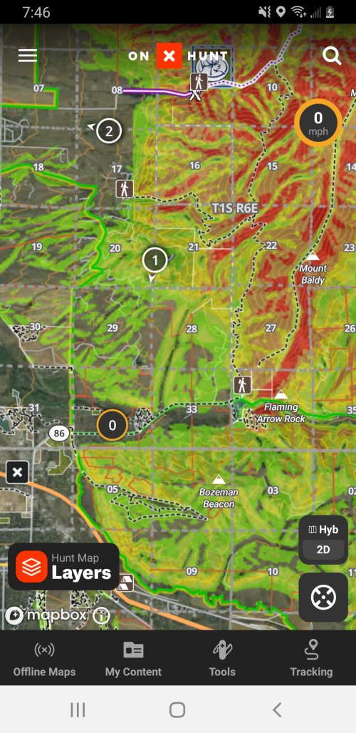
Not sure if you are looking for a database of unit difficulty? I'm not much help there, If you know the general area you are going using caltopo or Gaia slope shading is a good first stop... small stuff like 50' cliffs can hide but if you are seeing a bunch of oranges and reds it's going to be rough... if it's all green it shouldn't be too bad...
 
I have never paid for for but I know in Google searches TopRut pops up. I think it's the original GoHunt. But one of the sections in the paid membership is a scoring system on ease of terrain.

I would take that with a grain of salt though. Like @GrantK Said pick a general area and use caltopo shading. Every unit I have hunted has had moderate rolling hills to sheep country. And sometimes in very close proximity.
 
I have never paid for for but I know in Google searches TopRut pops up. I think it's the original GoHunt. But one of the sections in the paid membership is a scoring system on ease of terrain.
I forgot that one, mostly because its not really reliable...it's free if you have onX but take it with a giant grain of salt, it's just an average of all the terrains slope in the entire unit, sometimes it's correct but one big canyon or terrain feature can completely screw it up... or the elk are in the rough spots in an otherwise flat unit...
 
Personally, I'd pick a unit first, mark on the map where to expect elk to be, and then find some manageable terrain to access those places. Most units are neither midwest flat nor sawtooth steep, but have a variety of slopes in between the extremes. For WY specifically, the hunt unit description on the WG&F website will describe the terrain, including steepness.
 
Onx on a computer gives you a much better view of terrain. Just pan down and it gives you walk through view way more informative than just looking at elevation lines.
 
Google earth. Put the terrain exaggeration (forget the proper term) on 2x and if you look at it and say "that's not too bad" you're probably going to be screwed.
 
Topo maps. The hunt planner has a layer that shows various types of topos. Learn to read contour lines.
 
Back
Top