Ollin Magnetic Digiscoping System

Agricultural Fields Extending into Public on Mapping Apps

Rc1275

Active member
Joined
Aug 17, 2022
Messages
54
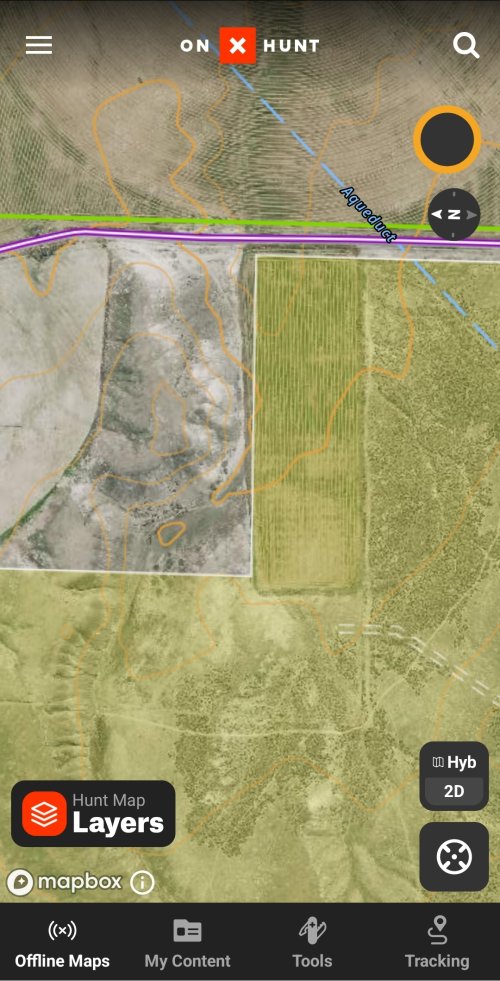
Does anyone encounter agricultural fields that extend onto land deemed public in hunt mapping apps?

I encounter this a few times.

Sometimes there is a fence often times not.Most times it is a sliver section sometimes it is a large chunk.

I finding it both extending on to national forest and also BLM.

Do you feel comfortable hunting the portion of the agricultural fields that extend onto the public as shown in the mapping apps?

Imagine below the white line being deemed public and above the white line being deemed private.
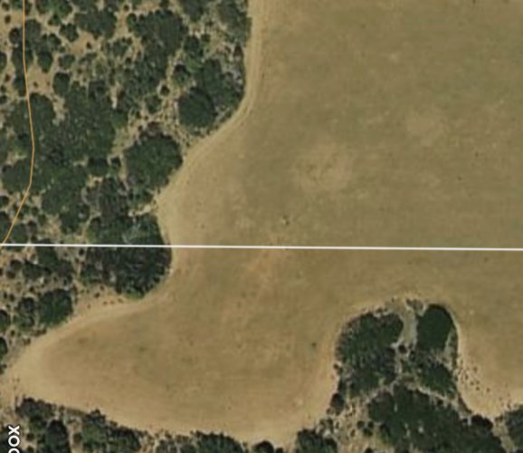
2FA5BDEB-C43E-4642-B864-640EFCDA7EFB.jpeg
 
I’ve encountered it and hunted the part that was public. I went to the local mapping office at the courthouse and printed the map along with the owners on it. Has the county seal right on the papers.
I’ve never had any issues but I have more than OnX in the event someone wants to try to argue with me.
 
I wouldn't feel comfortable in Idaho without talking to the landowner to the north. If that didn't go well I would probably be chatting with some folks at BLM. Being a surveyor, I have seen plenty of GIS stuff be wrong.

A person should know land is private and they are not allowed without permission because:
• The property is associated with a residence or business;
• OR cultivated;
 
There are literally hundreds if not thousands of instances like this across public lands of all sorts, could be mapping error, sometimes it's leased, sometimes it's trespass, sometimes it's trespass that was remedied by a lease, or other scenarios. You have to look at every instance and figure out what's going on to be sure, otherwise you could be in the wrong.
 
It may be a mapping error and the land is private. It may be a trespass, but if it is, the private landowner probably believes the land is his. Either way, if you go there, you are looking for a fight. I would just not go there.
 
Screenshot looks like someone trying to take advantage of every inch of arable land. Weird how that often trumps true boundaries .😀

That being said, who knows from a small screen shot.

What do other boundaries look like when you zoom out?
This is just an example. You can find a Ton of actual agricultural fields that ext ed into public land boundaries on onX/ GOHUNT maps. Most are just corners… this leaves me with another question. What Does forest service/ BLM do about encroachment onto their land with ag fields. As a hunter I would appreciate the essential food plots I could hunt, but I could imagine an awkward situation…. In the extreme like the Ammon Bundy standoff, but with crops not cattle lmao
 
If anyone’s follows private land boundless with their app you will see corners of ag fields extending into public… it seems to be very very common
 
it seems to be very very common
It is, the availability of aerial imagery has made it a lot easier to see, but addressing it is not simple, records searches, cadastral surveys, fun discussions with sometimes adversarial public, and many vacant staff positions in federal government = big backlog. BLM will sometimes negotiate a lease for the occupied acres when it's actual trespass depending on the situation, I know of portions of orchards that are on BLM with a lease until the current trees are removed from production, then they are supposed to vacate the BLM. I don't know whether the public still has access but I'm guessing not, which is rare with other types of BLM leases.
 
Could be the county is at it again. Funny thing is your boundaries with private individuals, particularly long standing ones, those are good. Have a boundary with a government entity, not so much.
 
Last edited:
It is, the availability of aerial imagery has made it a lot easier to see, but addressing it is not simple, records searches, cadastral surveys, fun discussions with sometimes adversarial public, and many vacant staff positions in federal government = big backlog. BLM will sometimes negotiate a lease for the occupied acres when it's actual trespass depending on the situation, I know of portions of orchards that are on BLM with a lease until the current trees are removed from production, then they are supposed to vacate the BLM. I don't know whether the public still has access but I'm guessing not, which is rare with other types of BLM leases.
There are leases from government agencies to private landowners that do not allow for hunting from all? I was under assumption that all federal agricultural leases had a requirement to allow public to hunt. I have ran into many instances where the ranch hand says “ we lease this from the blm so no trespassing” and then found out I can still hunt there. There are instances that they can lock it up as essentially private?

On the other hand I know some state land is leased prohibiting hunting.
I'm not certain, I'll have to look into it for this example, but there are rare instances with BLM where public access is limited, active mining operations or well pads for example. When the orchard gets planted and a deer fence constructed around it, then 5 years later someone realizes 5 acres of the orchard is trespass, it would be difficult to allow public access to the fenced BLM. I will look into for the instances I know of.
 
Being a surveyor, I have seen plenty of GIS stuff be wrong.
I’d also bet you’ve seen a LOT of posted properties or what people THINK they own extending well beyond reality too. I have much more faith in official GIS layers than most of what locals tell me is their boundary. Not saying to hunt “slivers” but if you are well within the mapped public block, 99% of time, maybe more, the modern mapping seems right. Double check two or more sources that also agree? I’d say your odds probably shoot to 99.99%. Who has the interest in pushing their line? For once, not the government usually.
 
On my property, the property lines on OnX and Montana Cadastral are 9.9 yards off per the OnX line distance tool. Property corners were confirmed with a survey when we bought the house. Those field encroachments look larger than 10 yards, but if my property lines can be off by 17% in GIS, I'd be hesitant to base my decision to hunt that cultivated land on OnX alone.
 
Does anyone encounter agricultural fields that extend onto land deemed public in hunt mapping apps?

I encounter this a few times.

Sometimes there is a fence often times not.Most times it is a sliver section sometimes it is a large chunk.

I finding it both extending on to national forest and also BLM.

Do you feel comfortable hunting the portion of the agricultural fields that extend onto the public as shown in the mapping apps?

Imagine below the white line being deemed public and above the white line being deemed private.

View attachment 266945
Montana has a lot of this. Several state sections around me have wheat fields on them that extend onto neighboring private land. I've hunted those ag fields on state with no issue. No sure if it's an old lease but very much active.
 
Leupold BX-4 Rangefinding Binoculars

Latest posts

Forum statistics

Threads
113,637
Messages
2,027,777
Members
36,259
Latest member
Zaner
Back
Top